Rosor Exploration
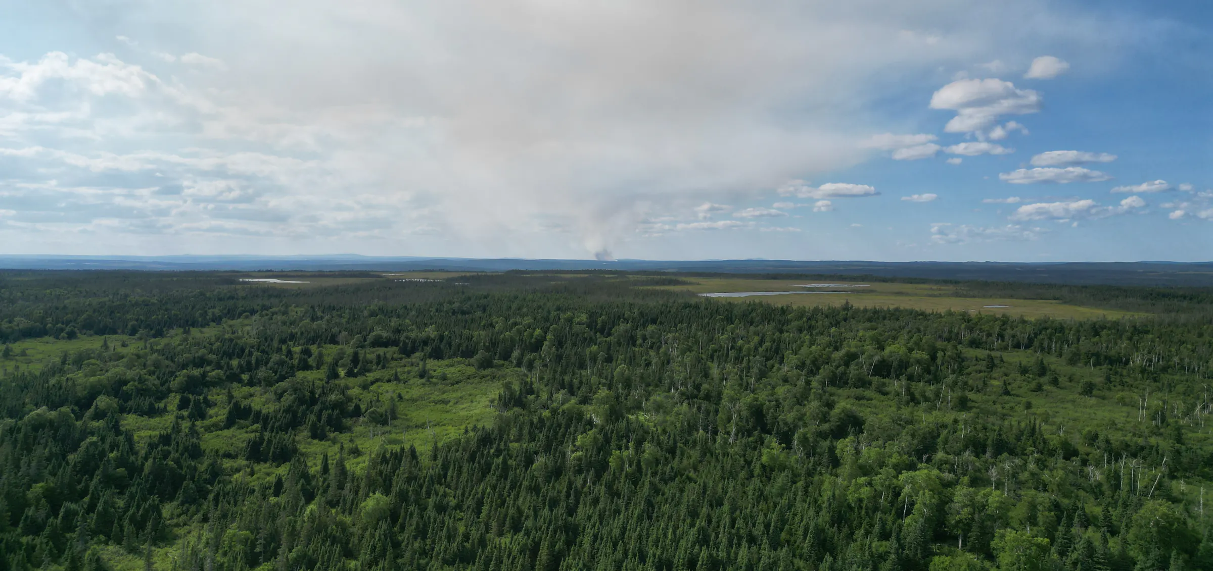
Boreal forest and muskeg to the horizon, seen from the air over a survey area

Data quality

Everyone promises clean data. We adjust the survey while we're still on your ground.

Every provider in this category asserts high-quality data. Almost nobody explains how they guarantee it. Here is our mechanism, in full, as it runs on magnetics and LiDAR programs.

Senior geologists tell us the same story.

A dataset looked fine in the field and fell apart on the processing bench three weeks later. The Zephyr Mag reports data-quality metrics that we review daily, and the field team adjusts acquisition on that evidence while the crew is still standing on your ground.

On-site QC

How does Rosor keep survey data clean?

Four commitments hold the standard on magnetics and LiDAR programs, and every one of them lands while the crew is still on your ground.

  1. 01

    The daily data-quality review

    The Rosor Zephyr Mag reports data-quality metrics which are reviewed daily. This allows the field team to adjust acquisition while the survey is underway and ensure a high-quality final dataset. Where a line has degraded from flight geometry, sensor swing or interference, it surfaces in that review and is corrected while the crew is still on your ground, rather than banked and rationalised later.

  2. 02

    External factors

    Solar activity corrupts magnetic readings mid-flight. An undocumented solar flare can throw off a whole block, and nobody notices until processing. The affected lines surface in the daily review and are re-flown while the crew is still on site.

  3. 03

    Complete flight plans

    Every Rosor flight plan includes the cross-check geometry that lets processing verify and level the dataset. We ensure that every line, on every edge of the survey area is properly closed with tie lines.

  4. 04

    Processing and microlevelling

    After the survey, the data is levelled against the cross-check geometry and then microlevelled to take out the last of the line-related noise. That is the step that turns a clean day in the field into a grid your team can interpret.

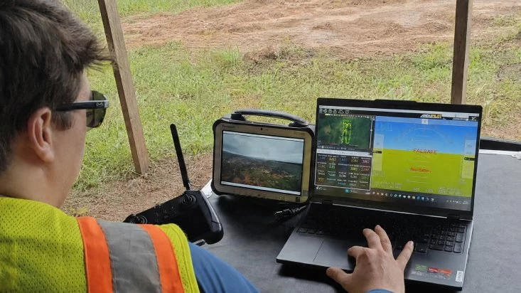
A Rosor pilot at a field ground station, watching survey telemetry on a laptop and the aircraft's camera feed on a rugged tablet
Reviewing the day's survey data at the ground station.

Terrain-following

Why clearance discipline matters

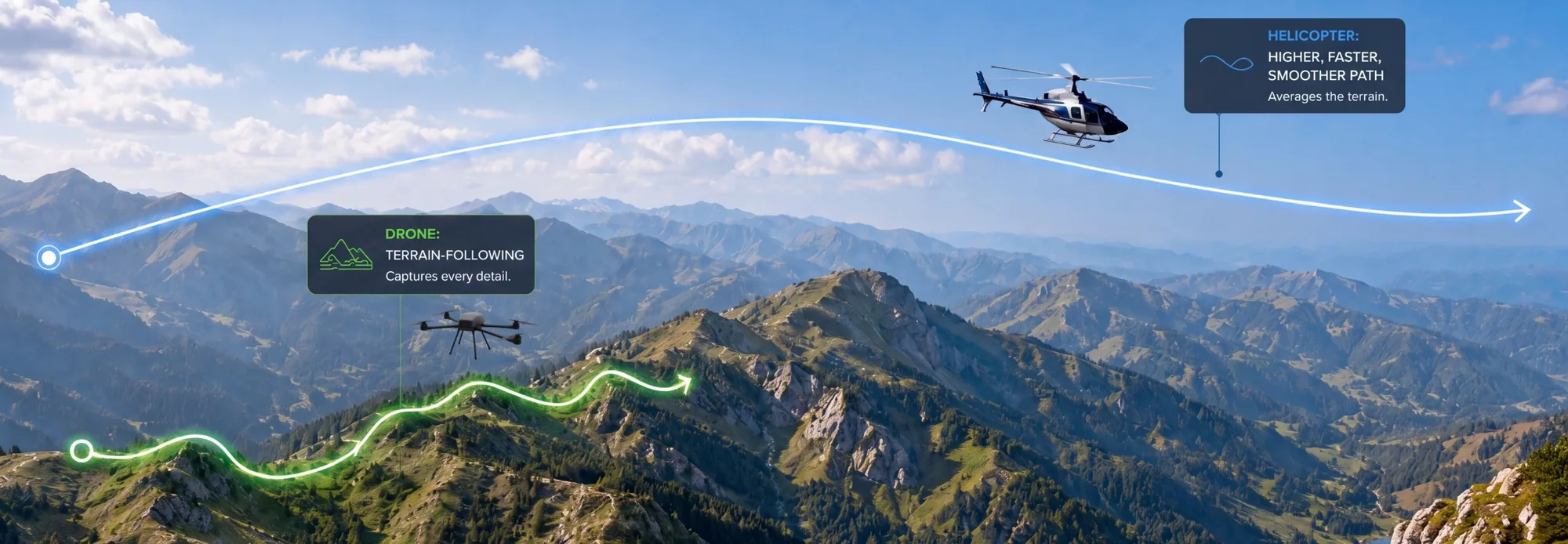
The sensor's distance from the ground determines data quality. Our drones closely follow the terrain at 5–100 m above the ground, rather than averaging it from higher up.

Every line is pre-programmed before the aircraft lifts off, and battery logic is set to finish a line wherever the endurance allows it, so breaks are planned rather than incidental. Pilots monitor battery, heading and speed telemetry, and obstacle detection holds a hover rather than pressing on. Where a client supplies LiDAR, it feeds the flight planner so we fly lower with confidence.

Diagram comparing a drone's terrain-following flight path at low level with a helicopter's higher, smoother arc over the same mountains
Recon Lite: terrain-following at 5–100 m captures what a high, fast pass via helicopter averages away.

The standard

What happens before the crew leaves

Four things are settled on site, while the survey can still be fixed.

  1. 01

    A line degrades

    It shows up in the daily review rather than on a processing bench weeks later, while the crew and the aircraft are still on the block.

  2. 02

    The re-fly

    Same block, same trip, in the same conditions. Re-flying later means a second mobilization, and the alternative is a grid that keeps the hole.

  3. 03

    External factors

    An undocumented solar flare can corrupt a whole block. It shows up in the daily metrics, so acquisition is adjusted before the crew demobilizes.

  4. 04

    Marginal data

    Re-flown, never banked. Data that is only arguably good enough is the kind that gets rationalised later, so it does not come home.

Legacy data

Can Rosor reprocess legacy data to fit our standards?

Yes, and one client specifically asked us to. St. Barbara approached Rosor with a legacy survey that had been acquired with inconsistent survey geometry.

We reprocessed and corrected the historic dataset, then integrated it with newly acquired survey blocks into a consistent regional dataset. The same levelling and quality-control methods we use to maintain continuity across our own acquisition lines were applied to the legacy data, reducing acquisition-related inconsistencies and recovering much of the value from a dataset affected by shortcomings in the original survey design.

Read the merged-survey program →

Proof

Programs flown to this standard

We publish these programs with the numbers and the client's own words. Their geologists made the calls, and the data held up underneath them.

Drone magnetics
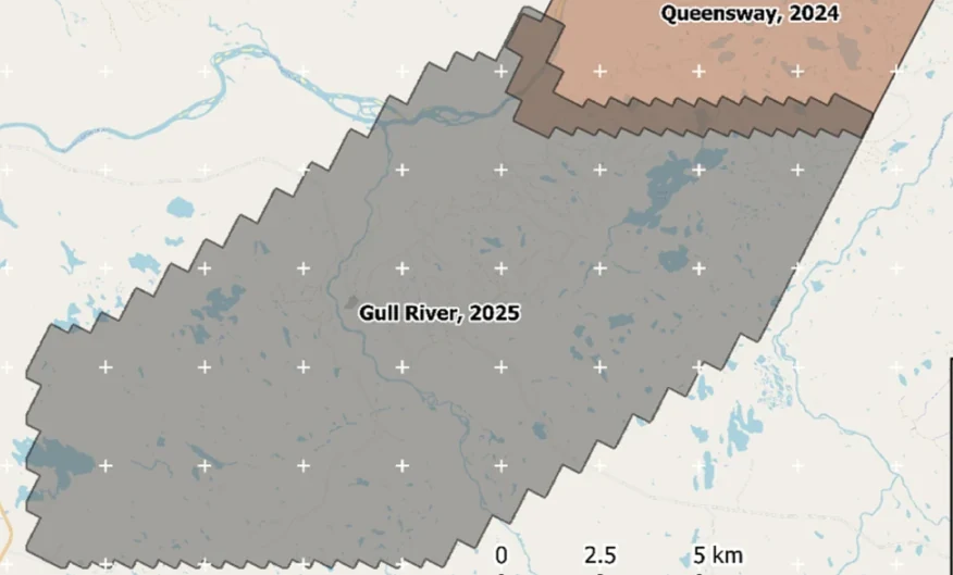
New Found Gold — Gull River survey figure

Gull River

Grand Falls-Windsor, Newfoundland

New Found Gold
315
line-km/day on this program
~4,000
line-km completed

Almost 4,000 line-kilometres acquired across the program, completed on schedule despite delays from a wildfire evacuation interrupting it and geomagnetic storms. Sustained production without trading away data quality.

“The drone magnetic survey provided high-resolution structural insights that significantly improved our understanding of the subsurface geology, allowing us to refine our exploration targets.”

David Drover · Project Geologist

Read the Case Study →

Drone magnetics
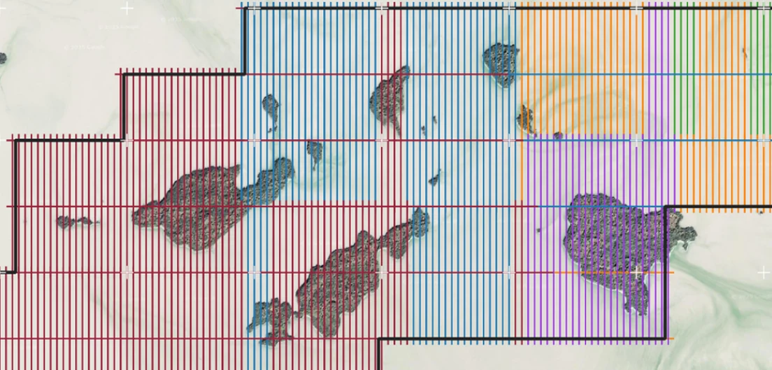
International Explorers & Prospectors — Abitibi Lake survey figure

Abitibi Lake

Abitibi Lake, Ontario, Canada

International Explorers & Prospectors
10
days, site to deliverables
3
days of acquisition

Mobilization to final deliverables in ten days, with acquisition complete in three and no mechanical downtime.

“Throughout the duration of the project, Rosor maintained clear and efficient communication with our team. They demonstrated a strong commitment to meeting deadlines by processing the collected data within a very tight time-frame, ensuring that our exploration schedule remained on track.”

Peter Colbert · CFO

Read the Case Study →

FAQ

Straight answers

01

What happens when a line fails the on-site review?

It is re-flown in the same conditions, before the crew leaves that block. The decision happens on site, before the crew demobilizes, so nothing marginal gets banked and rationalised later.

02

Do we get to see the quality control?

Yes. You get twice-weekly field updates with progress maps during acquisition, and the QC record travels with the dataset. Your team can see what was flown, what was re-flown and why.

03

Is validated field data the same as final data?

No. It is the raw material for it. On-site review guarantees the acquisition is sound, and processing, levelling and inversion then turn it into the grids and models your team interprets. Clean input is what makes every step downstream trustworthy.

04

Can you work with data flown by someone else?

Sometimes, and we have. On one program we custom-levelled a legacy survey flown without proper quality geometry and merged it with newly flown blocks into a single supergrid. Send us the historic data and we'll tell you what it can carry.

05

What formats do you deliver?

We deliver files that open in Leapfrog, QGIS and ArcGIS: DXF and isosurfaces, geotiffs that go into your existing datasets and raw data cleaned and leveled. The standard package is interpretation-ready, and an interpretive report and findings presentation come with scoped interpretation.

Talk to an expert

Send us your project details

A shapefile and a few key details are enough. We'll come back with a coverage plan, a budget range and the flight plan we'd fly it with.

Send us your shapefile. We'll come back with a preliminary read, a coverage plan and a budget range.