Rosor Exploration
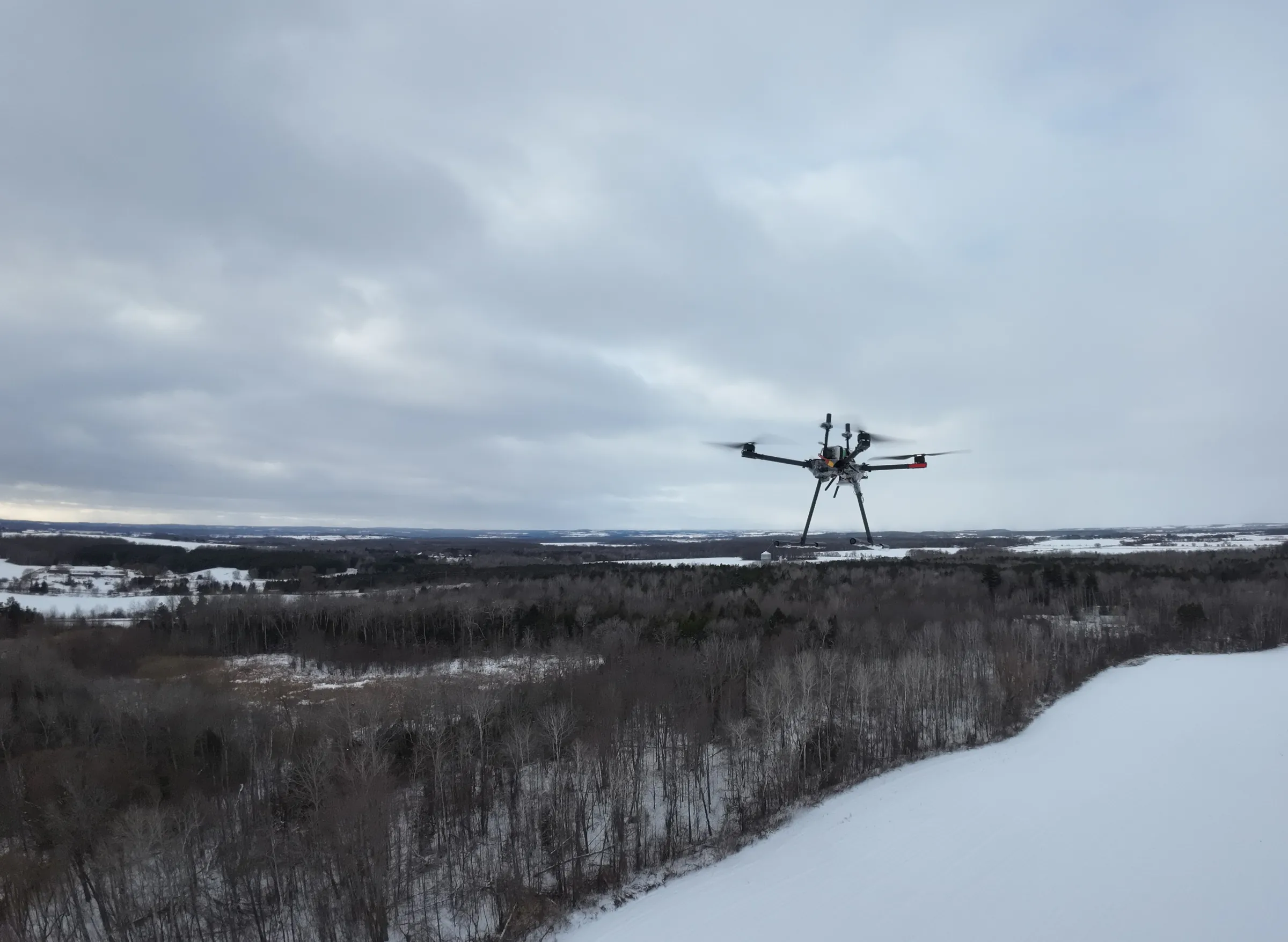
A Rosor survey drone hovering over a frozen wetland, with treeline and snow-covered ground behind it

For exploration geologists

Know where to drill.

Everyone promises clean data. We make sure it's being collected properly while we're still on site.

You're the one who has to defend the targets. Our job is the data you defend them with: here is the quality mechanism, the methods that fly together and what lands on your desk at the end.

Data quality

How do you know the data is clean before it reaches you?

Because it's checked while the crew is still on the ground. On magnetics programs the Zephyr Mag reports data-quality metrics that are reviewed daily, acquisition is adjusted on that evidence while the survey is underway, and the dataset is signed off on your ground rather than three weeks later on a processing bench.

  1. 01

    A daily data-quality review

    The Zephyr Mag reports data-quality metrics that are reviewed daily. Flight geometry, sensor swing, interference and solar events all degrade a line, and each one shows up in that review while the crew can still act on it.

  2. 02

    Re-fly on the spot

    A degraded line is re-flown in the same conditions before the crew leaves that block. Nothing marginal gets banked and rationalised later, because the re-fly decision happens on site.

  3. 03

    Validated before we leave your ground

    The dataset is checked complete and sound on site. You get twice-weekly field updates with progress maps, and the QC record travels with the data, so your team can see what was flown, what was re-flown and why.

  4. 04

    Complete flight-plan standards

    Every flight plan includes the cross-check geometry that lets processing verify and level the dataset. Terrain-following at 5–100 m AGL keeps the sensor close to the anomalies you're chasing.

One mobilization

Which methods can you fly in one mobilization?

Magnetics, electromagnetics (EM) and radiometrics fly with one crew on one mobilization, with LiDAR terrain collected on the same visit. Each sensor is flown at the altitude and line spacing where it performs best, so you avoid a second mobilization, a second weather window and the work of stitching datasets from different vendors.

  1. 01

    Magnetics

    Magnetics is the workhorse of most programs. It gives high-resolution total field and gradient data for structural corridors and lithological contacts, including faults and intrusions, and we fly it low and tight to the terrain.

  2. 02

    EM / SAEM

    Frequency-domain semi-airborne EM (SAEM) maps conductors and resistivity contrasts from surface down to 1000 m, including beneath cover. The transmitter is installed on the ground while the receiver flies on the drone. It gives your team a second physical property to read against the magnetics, without mobilizing a heliborne EM program.

  3. 03

    Radiometrics

    We fly a heavy radiometric crystal few drones can carry, and we fly it at heights where the counts mean something. Potassium alteration mapping supports targeting at surface.

  4. 04

    LiDAR

    LiDAR gives a terrain model precise enough for drill-pad planning and structural lineament work, and we collect it while the crew is already on your ground.

What you receive

What do you actually receive at the end?

You get drill targets you can act on. Interpretation runs as a conversation with your geologists rather than a hand-off at the end.

During processing and inversion, we work closely with your geologists and meet regularly to make sure your deposit model, structural framework, and ground truth are reflected in the interpretation as it develops. The result is a set of drill target recommendations signed by geoscientists and informed by your team's input. You are not left trying to decode someone else's work. You are working from an interpretation your team helped shape and can stand behind.

The deliverables are ready to open in Leapfrog, QGIS, and ArcGIS. You receive DXF surfaces and isosurfaces for your 3D model, GeoTIFFs that can be overlaid with your existing datasets without having to reproject everything, and the raw and processed data if you want to run your own inversions. The standard package is interpretation ready, and we can also provide a constrained model when you have the data needed to constrain it. Geological interpretation of the geophysical results is available as an additional scope and includes an interpretive report and presentation of the findings.

The dataset also becomes more valuable over time. Every hole adds to the information base, which means target selection can become more scientific and more focused on testing specific hypotheses. The survey continues to guide where you drill next, even after the field crew has left.

Proof

Programs like yours

The facts are the client-approved facts, and the words are their geologists' words.

Drone magnetics
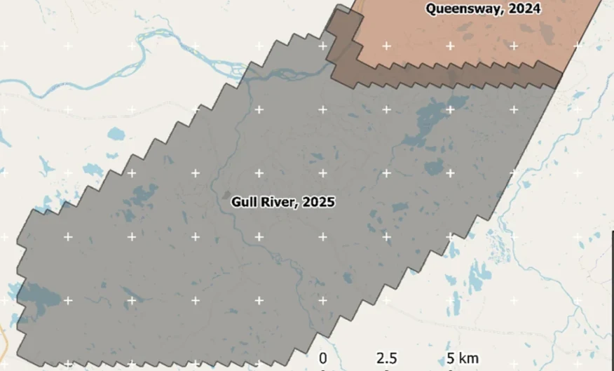
New Found Gold — Gull River survey figure

Gull River

Grand Falls-Windsor, Newfoundland

New Found Gold
315
line-km/day on this program
~4,000
line-km completed

Almost 4,000 line-kilometres acquired across the program, completed on schedule despite delays from a wildfire evacuation interrupting it and geomagnetic storms. Sustained production without trading away data quality.

“The drone magnetic survey provided high-resolution structural insights that significantly improved our understanding of the subsurface geology, allowing us to refine our exploration targets.”

David Drover · Project Geologist

Read the Case Study →
Drone magnetics
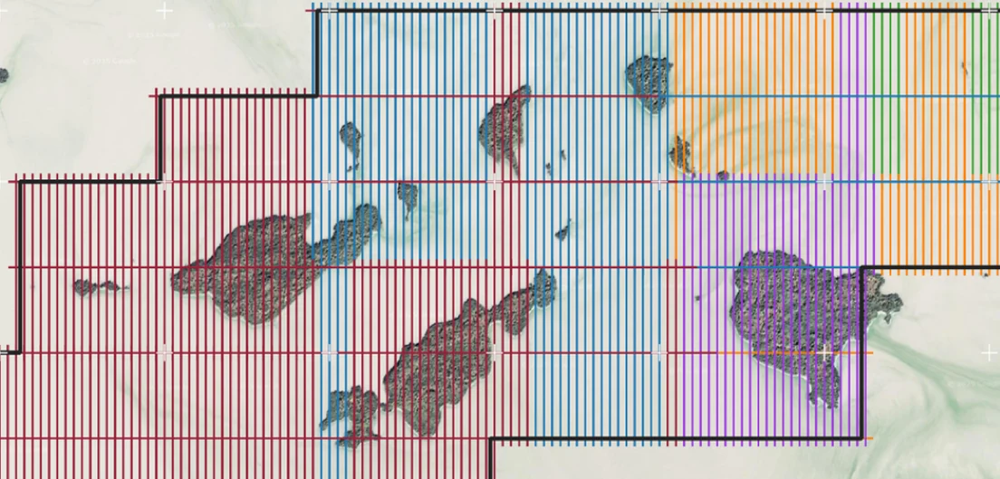
International Explorers & Prospectors — Abitibi Lake survey figure

Abitibi Lake

Abitibi Lake, Ontario, Canada

International Explorers & Prospectors
10
days, site to deliverables
3
days of acquisition

Mobilization to final deliverables in ten days, with acquisition complete in three and no mechanical downtime.

“Throughout the duration of the project, Rosor maintained clear and efficient communication with our team. They demonstrated a strong commitment to meeting deadlines by processing the collected data within a very tight time-frame, ensuring that our exploration schedule remained on track.”

Peter Colbert · CFO

Read the Case Study →

FAQ

Straight answers

01

Can you fly IP or MT?

No, we don't offer induced polarization (IP) or magnetotellurics (MT). Our frequency-domain semi-airborne EM reads resistivity at depth, from surface down to 1000 m, which is often what an IP request is really after. It does not measure chargeability. For true IP or MT programs, we'll point you to trusted partners.

02

How deep does the EM see?

From surface down to 1000 m. The transmitter is installed on the ground while the receiver flies on the drone. Actual depth depends on ground conductivity and target size, and resolution decreases with depth. If your target sits deeper than SAEM reads in your ground, we'll say so and tell you which method fits it.

03

Why should I trust drone data over a heliborne survey?

Because the magnetometer flies close to the source. Terrain-following at 5–100 m AGL gives sharp anomalies and good resolution of narrow structures, and on magnetics programs data-quality metrics are reviewed daily, so acquisition is adjusted while the crew is still on site. Semi-airborne EM adds a second physical property, conductivity, over the same ground without a second mobilization. At true regional scale, conventional airborne still wins on coverage economics.

04

What formats do you deliver?

Deliverables are in formats that open in Leapfrog, QGIS and ArcGIS. You get DXF and isosurfaces, geotiffs that go into your existing datasets and raw data cleaned and leveled, interpretation-ready as standard. An interpretive report and findings presentation come with scoped interpretation.

05

How fast can you be on our ground?

Send a shapefile and you'll have a quote inside a week, and we mobilize on a contract. One client had a crew on site on a few weeks' notice. In the field, crews fly up to 500 line-km of magnetics a day with multi-drone surveys on open ground within reach of roads, and less where terrain or access is harder. Deliverables arrive within an average of 15 business days of completion.

Talk to an expert

Send us the target you're building the case for.

A shapefile and your deposit model are enough. A geophysicist will come back with a method recommendation, a coverage plan and a budget range.

Send us your shapefile. We'll come back with a preliminary read, a coverage plan and a budget range.