Rosor Exploration
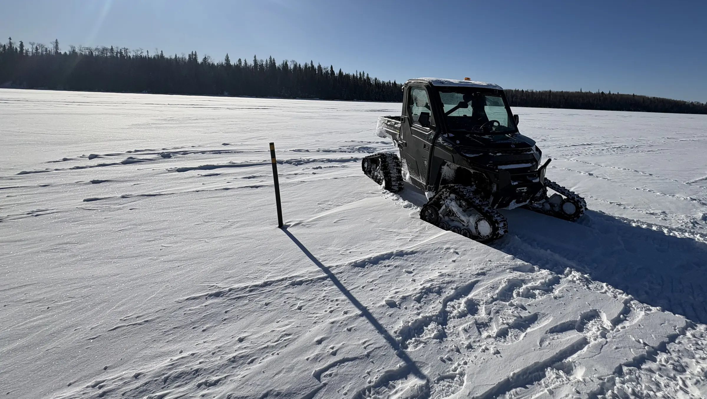
A tracked utility vehicle on a frozen lake at a Rosor survey site, with survey marker and crew tracks in the snow

For exploration managers

You've managed enough vendors to know: the data is only half the job.

The other half is delivery. You want crews that don't need babysitting, updates that arrive on schedule and a record you can check before you sign.

Rosor runs self-sufficient crews, reports twice a week with progress maps and publishes case results from real programs. You can check that record before you commit a field season to it.

On a live program

What does working with Rosor look like on a live program?

You get twice-weekly field updates with progress maps, self-sufficient crews and production you can plan a season around.

  1. 01

    Twice-weekly field updates

    During acquisition you receive progress maps and status twice a week. Each update covers what was flown, what was re-flown and where the crew goes next. Your team is never guessing where the survey stands, and your own reporting up the chain writes itself.

  2. 02

    Self-sufficient crews

    Our crews arrive with their own logistics, Starlink connectivity and field workflow. They don't draw on your camp resources or your site manager's attention. One published program completed ~4,000 line-km despite forest-fire evacuations interrupting it.

  3. 03

    Production you can schedule against

    On the published Gull River program our crews averaged 315 line-km per day with peaks above 400, under favourable conditions. Those are acquisition numbers from a real survey, and that is the rate that keeps a drill season's critical path intact. Crews fly up to 500 line-km of magnetics a day with multi-drone surveys on open ground within reach of roads, and less where terrain or access is harder.

  4. 04

    Deliverables on a known clock

    Deliverables arrive within an average of 15 business days of completion. They land interpretation-ready, in formats that open in Leapfrog, QGIS and ArcGIS. You get DXF, isosurfaces and geotiffs that go into your existing datasets.

References

Can we speak to your past clients?

Yes. References are available on request, and they are exploration managers and VPs who have run Rosor programs.

They can speak to crew conduct, communication cadence and how we handle the days that don't go to plan. Ask during the consultation and we'll connect you directly.

Read the published programs →

Proof

Programs with the numbers attached

Each program below is published with its production figures and the client's own words. Check them before you check the references.

Drone magnetics
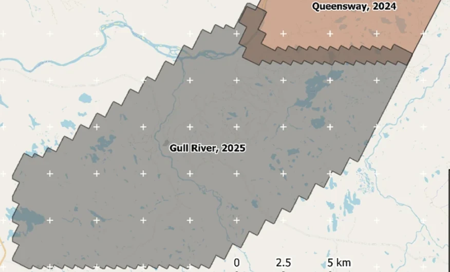
New Found Gold — Gull River survey figure

Gull River

Grand Falls-Windsor, Newfoundland

New Found Gold
315
line-km/day on this program
~4,000
line-km completed

Almost 4,000 line-kilometres acquired across the program, completed on schedule despite delays from a wildfire evacuation interrupting it and geomagnetic storms. Sustained production without trading away data quality.

“The drone magnetic survey provided high-resolution structural insights that significantly improved our understanding of the subsurface geology, allowing us to refine our exploration targets.”

David Drover · Project Geologist

Read the Case Study →

Drone magnetics
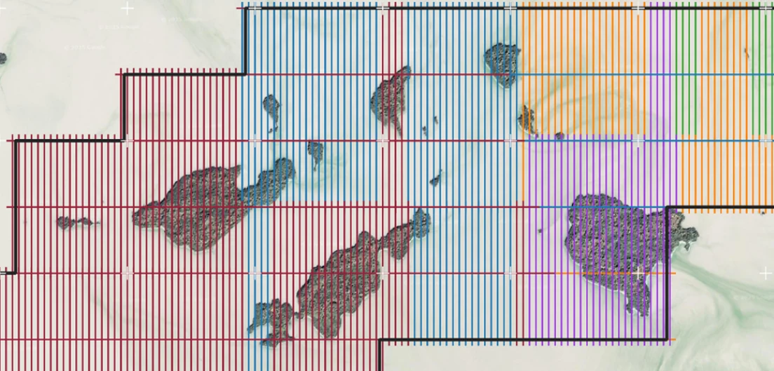
International Explorers & Prospectors — Abitibi Lake survey figure

Abitibi Lake

Abitibi Lake, Ontario, Canada

International Explorers & Prospectors
10
days, site to deliverables
3
days of acquisition

Mobilization to final deliverables in ten days, with acquisition complete in three and no mechanical downtime.

“Throughout the duration of the project, Rosor maintained clear and efficient communication with our team. They demonstrated a strong commitment to meeting deadlines by processing the collected data within a very tight time-frame, ensuring that our exploration schedule remained on track.”

Peter Colbert · CFO

Read the Case Study →

FAQ

Straight answers

01

Can Rosor run concurrent projects?

Yes. We field multiple self-sufficient crews and can run surveys on separate properties in parallel. During scoping we'll confirm crew availability against your dates before we commit, so a signed contract means a real mobilization slot.

02

How do you handle a multi-month program?

We run it the same way as a two-week program, just sustained. The survey design is agreed with your geologists up front, twice-weekly field updates with progress maps run throughout, and deliverables roll out by block so your team interprets while we're still flying. Crew rotations are our problem to manage, not yours.

03

What does the field reporting cadence look like?

You get twice-weekly updates during acquisition. Each one carries progress maps, line-km completed, QC status including any re-flights and the plan for the days ahead. If weather or space weather changes the schedule, you hear it from us first, before it reaches your site manager.

04

Can Rosor go through our vendor registry and procurement process?

Yes. We routinely complete vendor onboarding, including insurance certificates, safety documentation, Transport Canada certifications and references. We can also quote from a shapefile inside a week, so procurement and scoping run in parallel instead of in sequence.

Talk to an expert

Check the record before you commit a season.

Send a shapefile and your dates. We'll come back with a coverage plan, a budget range and references you can call.

Send us your shapefile. We'll come back with a preliminary read, a coverage plan and a budget range.