Rosor Exploration
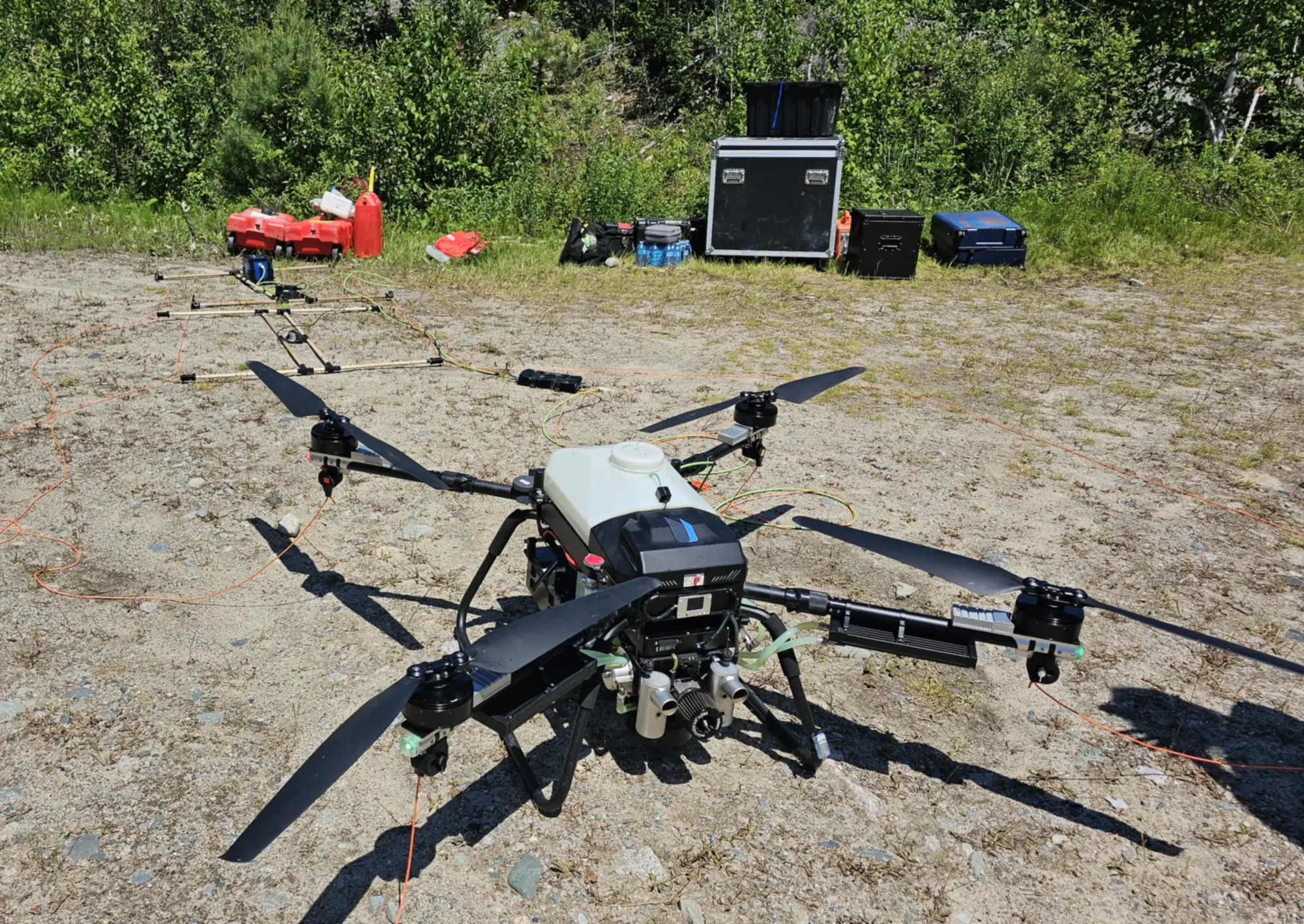
A Rosor Recon Heavy set up on a gravel pad at a field site, ready to fly

Radiometric surveys

Radiometrics maps elemental concentrations, not just what's altered.

Gamma-ray spectrometry reads potassium, thorium and uranium at surface.

That makes it the surface isotopic layer of a survey: where the rocks changed, where they're exposed, and where radioelement concentrations differ at surface.

The method

How does a radiometric survey work?

A radiometric survey measures natural gamma emissions from radioactive decay in surface and near-surface rock, using a scintillation spectrometer that resolves the spectrum into its potassium, thorium and uranium peaks. Those emissions come from every radioactive element present; these three are the diagnostic ones.

Every rock emits a faint gamma-ray signature from the radioactive elements it contains, and the potassium, thorium and uranium ratios can differ by rock type and by alteration. Mapped across a property, radiometrics can distinguish lithologies, outline alteration zones and detect outcrop in heavily vegetated areas. Detecting those areas is critical for many early-stage exploration projects. It reads the surface, not the rock a drillhole will reach, so its job is to help you decide where drillholes are worth planning in the first place.

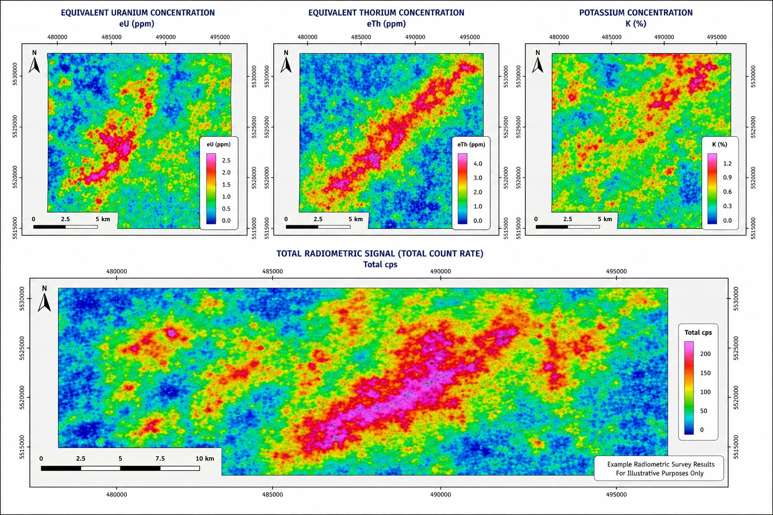
Four radiometric survey panels: equivalent uranium concentration, equivalent thorium concentration, potassium concentration, and the combined total radiometric count-rate signal, each with a colour legend and scale bar
Potassium, thorium and uranium channels, and the total radiometric signal they combine into. Example results, for illustrative purposes only.

The payload

Why does crystal size matter?

Radiometric surveys depend on collecting enough gamma-ray counts to separate real geological variation from statistical noise. Larger scintillation crystals collect more photons and improve counting precision, while smaller detectors trade sensitivity for lower weight. Rosor sits between typical lightweight drone systems and the much larger detector arrays carried by helicopters or fixed-wing aircraft.

  1. 01

    A drone-scale crystal

    Rosor's platforms carry a radiometric crystal larger than many drone systems can practically lift. That extra detector volume improves count statistics for potassium, uranium and thorium, producing more stable, geologically useful measurements while remaining light enough to fly close to the ground at low speed.

  2. 02

    Flown low, tight, terrain-following

    Detector size is only part of the equation. Gamma-ray intensity decreases rapidly with altitude, and slower flight increases the number of counts collected per metre of ground. Rosor can offset some of the sensitivity advantage of larger airborne systems while achieving a much smaller measurement footprint. The result is denser sampling, sharper lithological and alteration boundaries, and better spatial definition of localized anomalies.

What it's for

What is a radiometric survey used for?

Three jobs: mapping hydrothermal alteration associated with gold and copper systems, mapping surface uranium concentration, and discriminating lithology where bedrock is exposed.

  1. 01

    Potassium alteration in gold exploration

    Hydrothermal systems associated with gold are commonly enriched in potassium in the surrounding rock. The potassium reading maps that alteration footprint at surface, so your geologists can trace altered corridors along strike and rank which structures deserve follow-up before committing a drill program.

  2. 02

    Uranium exploration, at surface

    Radiometrics measures surface uranium concentration, which on a uranium property maps surface expressions, boulder trains and prospective ground. It does not detect buried mineralisation. On a uranium property with exposure it is commonly one of the first airborne layers flown.

  3. 03

    Lithology contrasts for mapping

    Distinguishes different rock units based on their characteristic potassium, uranium, and thorium concentrations, helping map geological contacts and variations in bedrock composition.

One mobilization

Does radiometrics need its own survey?

No. Radiometrics flies in the same mobilization as magnetics, which is the standard pairing. One crew on site, one co-registered dataset.

Acquired in the same mobilization, the two datasets arrive co-registered, so your team can read them side by side without forcing separate surveys to agree. What the magnetic layer contributes is set out on its own page. Adding radiometrics to a planned magnetic program is a marginal add to the mobilization, not a second campaign.

Drone magnetic surveys →

Proof

Programs on real ground

The same crews and the same quality mechanism, on exploration ground with real deadlines.

Drone magnetics
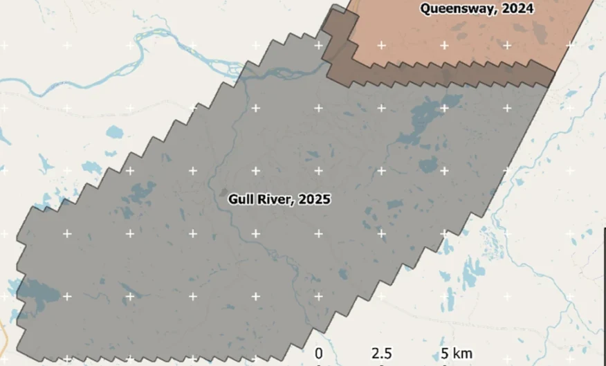
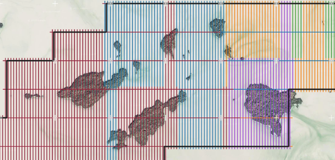
New Found Gold — Gull River survey figure

Gull River

Grand Falls-Windsor, Newfoundland

New Found Gold
315
line-km/day on this program
~4,000
line-km completed

Almost 4,000 line-kilometres acquired across the program, completed on schedule despite delays from a wildfire evacuation interrupting it and geomagnetic storms. Sustained production without trading away data quality.

“The drone magnetic survey provided high-resolution structural insights that significantly improved our understanding of the subsurface geology, allowing us to refine our exploration targets.”

David Drover · Project Geologist

Read the Case Study →

Drone magnetics
International Explorers & Prospectors — Abitibi Lake survey figure

Abitibi Lake

Abitibi Lake, Ontario, Canada

International Explorers & Prospectors
10
days, site to deliverables
3
days of acquisition

Mobilization to final deliverables in ten days, with acquisition complete in three and no mechanical downtime.

“Throughout the duration of the project, Rosor maintained clear and efficient communication with our team. They demonstrated a strong commitment to meeting deadlines by processing the collected data within a very tight time-frame, ensuring that our exploration schedule remained on track.”

Peter Colbert · CFO

Read the Case Study →

FAQ

Straight answers

01

Can a radiometric survey detect uranium at depth?

No. Radiometrics is a surface method, because gamma rays only escape the top ~30 cm of rock or soil, so it maps uranium at surface rather than buried mineralization. On a uranium program it maps surface expressions, boulder trains and prospective ground. Magnetics and electromagnetics (EM) map what sits at depth, EM from surface down to 1000 m, and your drilling tests it.

02

What do the K, Th and U readings actually tell me?

Each maps the surface concentration of one radioelement, and the ratios between them are the interpretation tool. Potassium enrichment can flag hydrothermal alteration. Thorium is relatively immobile, so K/Th ratios help separate alteration from a simple change in rock type. Uranium maps surface uranium concentration. Together they help discriminate lithology where bedrock is exposed.

03

Why does the size of the detector crystal matter?

Because gamma rays arrive sparsely, and counting statistics decide data quality. A larger scintillation crystal intercepts enough radiation to produce clean, interpretable potassium, thorium and uranium readings, while a small one produces noise dressed up as a map. Most drones can't lift a crystal this size. Rosor's platforms carry one, flown low and terrain-following where the signal is strongest.

04

When should I add radiometrics to a magnetic program?

When your ground has exposed bedrock or thin residual cover and alteration or lithology is part of the question, which covers most gold, copper and uranium programs at the targeting stage. It flies in the same mobilization as magnetics, so the add is marginal. If your ground is heavily covered, we'll tell you up front that radiometrics won't earn its place.

Talk to an expert

Will radiometrics progress your understanding of your geology?

Send the shapefile. We'll tell you whether radiometrics will earn its place on your program.

Send us your shapefile. We'll come back with a preliminary read, a coverage plan and a budget range.