Rosor Exploration

For consulting geoscientists

An extension of your team.

You spec the survey. We fly it to your standard and hand you data your recommendation can stand on.

The program, the interpretation and the client relationship stay yours. We are the acquisition arm you point at the ground.

Flight height
5–100 m AGL
Magnetics, open ground
Up to 500 line-km/day
Quote turnaround
Inside a week
Formats
Leapfrog, QGIS, ArcGIS & more

How it runs

What does working with Rosor look like for a consultant?

You set the parameters and we execute them. The QC record travels with the data, so when your client asks how you know the dataset is sound, you have the answer in writing.

  1. 01

    Co-designed survey parameters

    We work out line spacing, orientation, terrain clearance and sensor selection with you, against whatever you already know about the geology and what the program is trying to determine, before a single line is flown. Terrain clearance runs 5–100 m AGL on most programs, and you decide where in that band it sits. If you've already written the spec, we fly it. If you want a second read on it, our geophysicists will give you one, and the final call stays yours.

  2. 02

    Survey progress updates

    On magnetics programs, data-quality metrics are reviewed daily and acquisition is adjusted while the survey is underway. You get survey coverage maps showing the line-kilometres completed, so you can plan ahead and know when your final products are arriving.

  3. 03

    Deliverables that open in your client's software

    Files arrive in formats that open in Leapfrog, QGIS and ArcGIS. You get DXF and isosurfaces, geotiffs that drop into the existing project and raw data if you want to run your own processing. Complete flight-plan standards mean the dataset levels properly and merges with what is already on the property.

Proof

Proof you can hand to your client

Published programs come with the numbers and the client's own words. That is the third-party record a recommendation to fly can rest on.

Drone magnetics
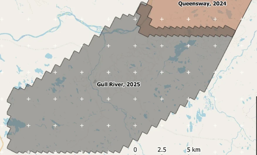
New Found Gold — Gull River survey figure

Gull River

Grand Falls-Windsor, Newfoundland

New Found Gold
315
line-km/day on this program
~4,000
line-km completed

Almost 4,000 line-kilometres acquired across the program, completed on schedule despite delays from a wildfire evacuation interrupting it and geomagnetic storms. Sustained production without trading away data quality.

“The drone magnetic survey provided high-resolution structural insights that significantly improved our understanding of the subsurface geology, allowing us to refine our exploration targets.”

David Drover · Project Geologist

Read the Case Study →

Drone magnetics
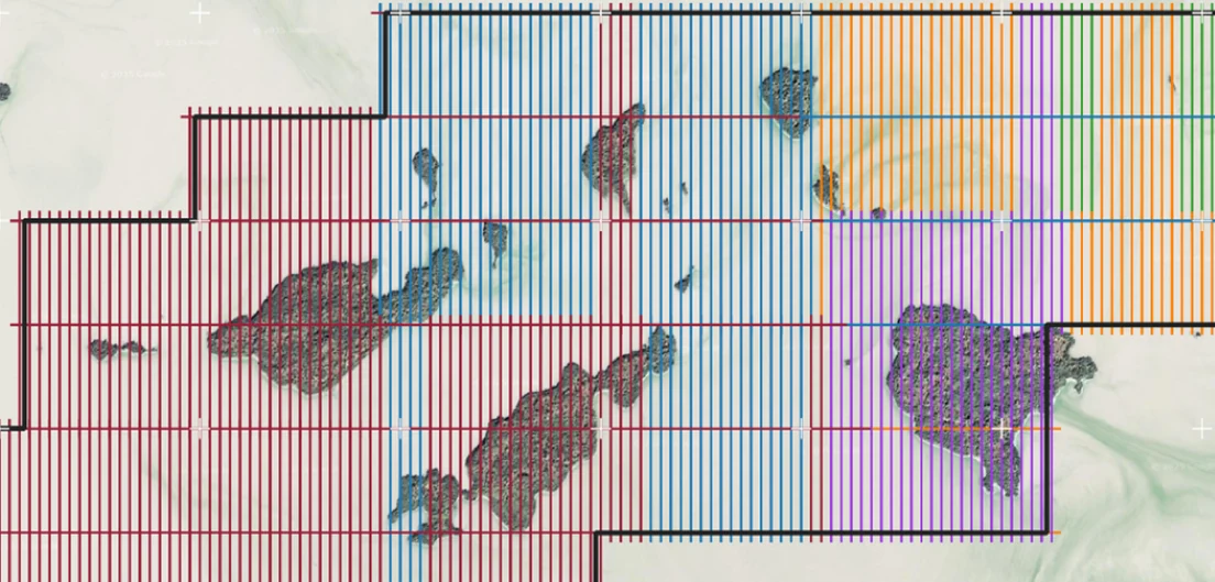
International Explorers & Prospectors — Abitibi Lake survey figure

Abitibi Lake

Abitibi Lake, Ontario, Canada

International Explorers & Prospectors
10
days, site to deliverables
3
days of acquisition

Mobilization to final deliverables in ten days, with acquisition complete in three and no mechanical downtime.

“Throughout the duration of the project, Rosor maintained clear and efficient communication with our team. They demonstrated a strong commitment to meeting deadlines by processing the collected data within a very tight time-frame, ensuring that our exploration schedule remained on track.”

Peter Colbert · CFO

Read the Case Study →

FAQ

Straight answers

01

Who owns the interpretation?

You do. It is your program and your call, and we deliver to the line you draw. If you want acquisition and processing only, that is the scope. If you want our geophysicists in the room as a second read, we work under your direction and your name goes on the recommendation.

02

Can we white-label or co-present the findings?

Yes to both. Some consultants present Rosor data under their own program branding; others bring us into the client presentation to speak to acquisition and QC while they own the interpretation. Either way, the client relationship is yours and we follow your lead on how we show up.

03

How does quoting work for a consultant-run program?

Send us the shapefile and your spec. We come back with a preliminary read, a coverage plan and a budget range inside a week, in a form you can put in front of your client. We mobilize on a contract and move as soon as it is signed, which matters when your client's field season or flow-through deadline is the clock.

04

How fast does a program run in the field?

Crews fly up to 500 line-km of magnetics a day with multi-drone surveys on open ground within reach of roads, and less where terrain or access is harder. Deliverables arrive within an average of 15 business days of completion. If your client's field season sets the clock, we scope the schedule to your ground so you can put a date in the recommendation and hold it.

05

Do you compete with us for interpretation scope?

No. Consultants are how a large share of our work arrives, and taking interpretation scope from the person who specs the surveys would be a bad trade. Where we do offer interpretation, it is for clients who arrive without a consultant. Where you are already engaged, we work to your scope.

Talk to an expert

Send us the ground and the spec.

A shapefile and your parameters are enough. We'll come back with a coverage plan and a budget range you can put in front of your client.

Send us your shapefile. We'll come back with a preliminary read, a coverage plan and a budget range.