Almost 4,000 line-kilometres through fire and geomagnetic storms.
Gull River · Grand Falls-Windsor, Newfoundland · 157 km²
315
line-km/day on this program
~4,000
line-km completed
Background
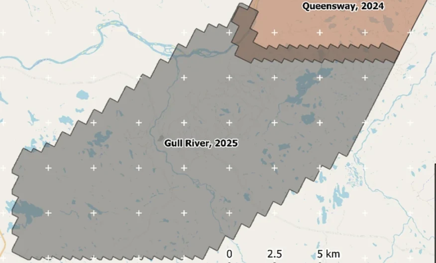
Coverage of the Gull River Project with the 2024 Queensway survey.
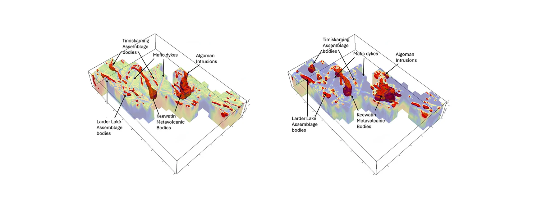
Located 50 km south of Grand Falls-Windsor, Newfoundland is the Gull River Project, the southern extension to the Queensway Project and 100% owned by New Found Gold (NFG). Rosor was contracted to fly 3,850 line-kilometers over the Gull River Project to merge with the Queensway Project to create one supergrid over the area. The block and survey was designed around a previous drone-borne magnetic survey flown by Rosor in early 2024 to create a supergrid over NFG's project areas. Rosor was tasked with collecting and processing data, to merge the data with the Queensway survey, and to delineate the magnetic bodies hosting the Gull River Project.
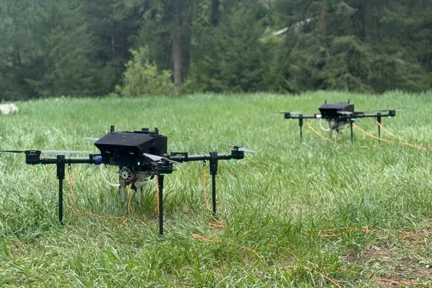
Gull River has an approximate area of 157 km². The survey plan comprised of 425 planned traverse lines oriented NNW-SSE (N300°/N120° azimuth) and 33 tie lines planned perpendicular (N030°/N210° azimuth), with sufficient overlap with the Queensway survey to ensure seamless merging of final products. The field team deployed with their test-and-proven Recon Lite, a lightweight drone designed in-house to handle adverse conditions while having long range and large payload for a drone.
Outcome
The multi-robot Recon Lite deployment used on the Gull River survey.
Data acquisition occurred in two phases: from July 15 to August 8, 2025 and from August 25 to September 8, 2025. The first phase of acquisition was marred by bad weather before the crew had to be evacuated from the area due to nearby forest fires. The second phase of acquisition proved to be the most productive stretch of acquisition for any project Rosor has done. With thunderstorms and geomagnetic storms causing delays, Rosor's field crew achieved an average of 315 line-km a day, with three days with over 350 line-km of data, with one day exceeding 400 line-km of clean magnetic data.
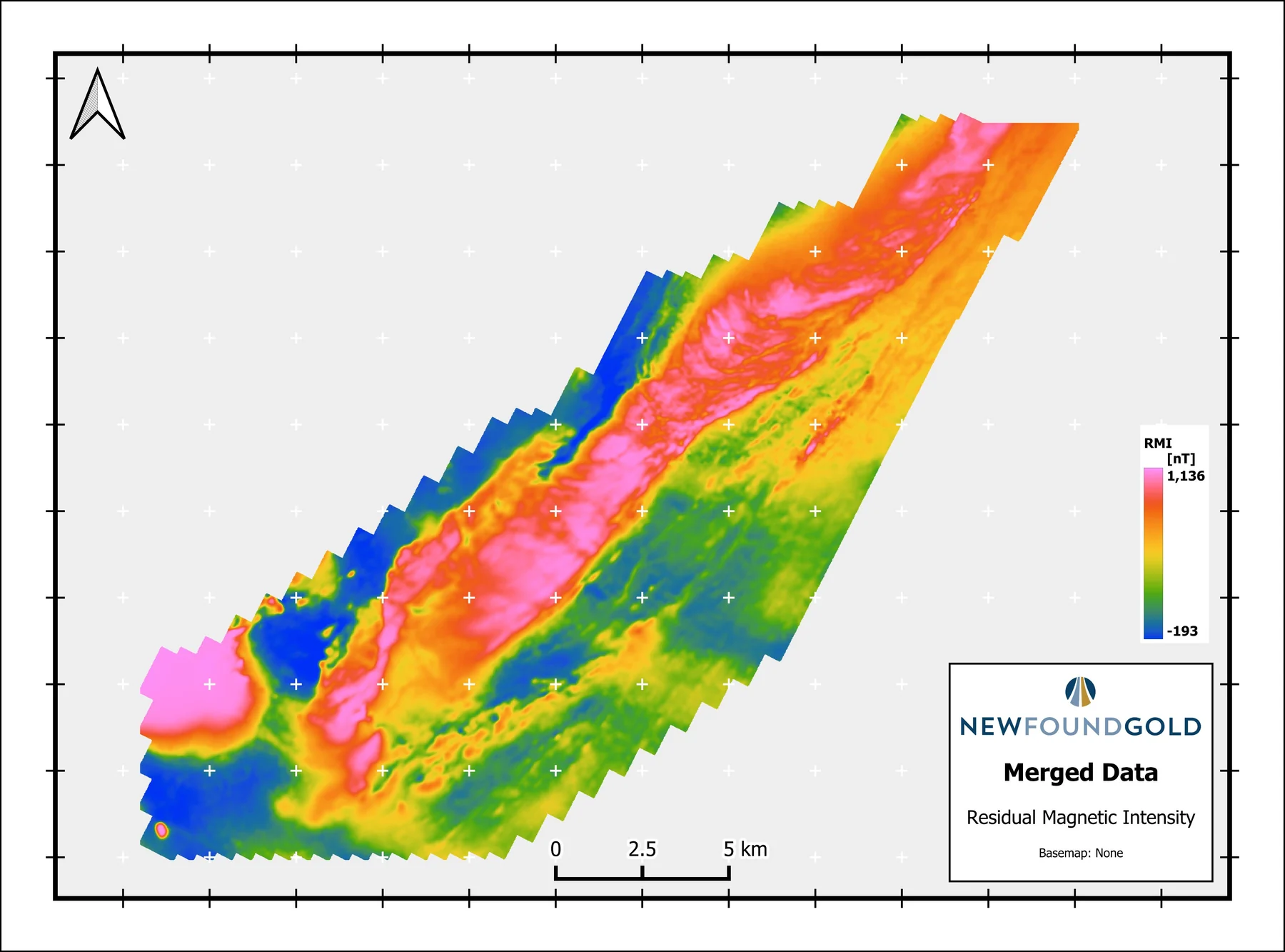
The data was processed using Rosor's refined in-house processing workflow to process the survey in near-record time (per line-km) to get a completed dataset to assist in their exploration. The residual magnetic intensity grids from both surveys were merged together using Oasis Montaj's gridknit extension. The resulting grid was a cohesive super grid that directly correlated with geology provided by NFG while also providing new insights into potential targets for follow-up.
In total, Rosor's field crew acquired almost 4,000 line-kilometers of line data despite setbacks from forest fires and geomagnetic storms. At full production days, there were multiple days where production approached 400 line-km, a rarity in drone-borne geophysical surveying. This is larger part due to the deployment of the Recon Lite, a drone developed in-house that has significant range while having a larger-than-average payload. With the Recon Lite, the field crew was able to acquire more lines per flight.
Gull River proved the effectiveness of the Recon Lite, and scratches the surface of what Rosor can achieve in terms of high-quality acquisition and production of geophysical data.
Peak production exceeded 400 line-km in a single day.
“
The drone magnetic survey provided high-resolution structural insights that significantly improved our understanding of the subsurface geology, allowing us to refine our exploration targets.
David Drover · Project Geologist, New Found Gold
The merged residual magnetic intensity grid for the Gull River and Queensway projects.
The document
The Gull River Case Study
Both acquisition phases, the daily production record, and the merge with Queensway, as delivered to New Found Gold.
Mobilization to final deliverables in ten days, with acquisition complete in three and no mechanical downtime.
“Throughout the duration of the project, Rosor maintained clear and efficient communication with our team. They demonstrated a strong commitment to meeting deadlines by processing the collected data within a very tight time-frame, ensuring that our exploration schedule remained on track.”
Thirteen priority areas delineated from ML-assisted interpretation, ranked for follow-up.
“Rosor has helped our exploration efforts both on the ground and with the drill bit utilizing their drone-borne surveys. They communicated effectively throughout the work program and processed the data within our tight time frame. We enjoy working with the team and look forward to using them again.”