Rosor Exploration
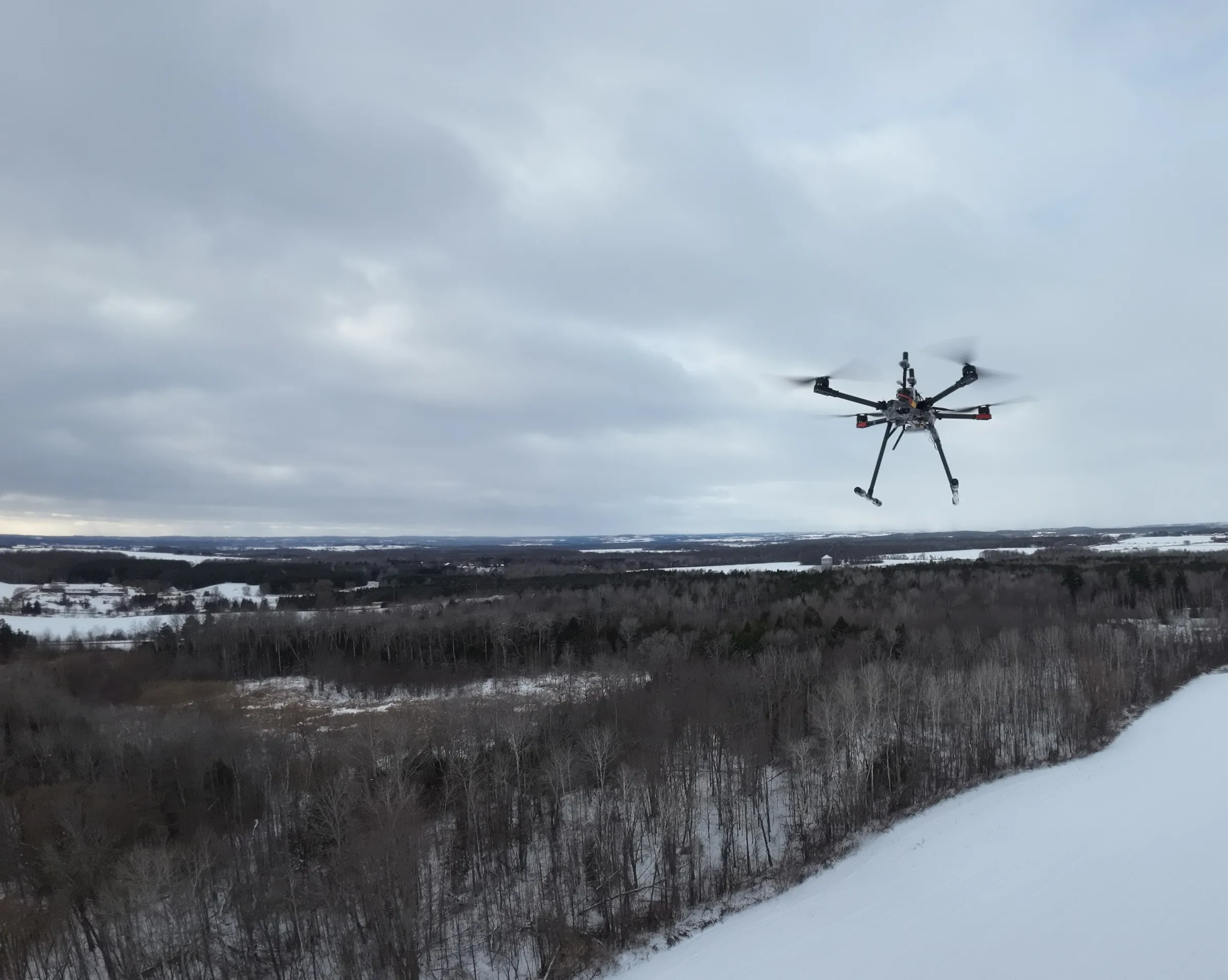
Rosor survey drone in flight over snow-covered forest and open ground

Drone LiDAR surveys

Drone LiDAR for mineral exploration.

Exploration deliverables: bare-earth terrain under canopy, outcrop identification, structural lineaments and access planning for your drill program.

For explorers, LiDAR answers a specific question. What does the ground actually look like under the trees? Where is bedrock exposed, where do faults trace and where can a drill actually get to?

Why explorers use it

Why do explorers use LiDAR?

Four reasons, all of them about drilling better holes: finding outcrop to sample, sharpening co-acquired geophysics, tracing structure under cover and planning drill access.

  1. 01

    Outcrop identification for sampling

    For commodities with little or no geophysical expression, such as lithium pegmatites and some rare earth systems, surface sampling is the primary vector. A bare-earth model shows every exposure on the property, so your field crews walk to outcrop instead of searching for it.

  2. 02

    Terrain corrections that sharpen geophysics

    Magnetic and radiometric data are both influenced by terrain and sensor height above ground. A precise LiDAR surface provides a high-resolution elevation model for terrain correction and processing, helping reduce topographic effects and improve confidence in the shape, strength and interpretation of geophysical anomalies.

  3. 03

    Lineaments and fault traces under forest cover

    Structural corridors control mineralization in most deposit styles. Hillshades from a bare-earth model reveal lineaments, fault scarps and lithological contacts that canopy hides completely, giving your geologists structure they can chase along strike.

  4. 04

    Drill access planning

    A target you can't get a drill to isn't a target yet. Slope, drainage, old workings and existing trails all read directly off the model, so pad locations and access routes are planned on real terrain before anyone commits machinery.

The method

Can LiDAR see through trees?

Not through them, but through the gaps between them. The laser doesn't pass through a tree. It fires enough pulses that some find openings in the canopy and reach the ground, and enough of those ground returns reconstruct the terrain surface precisely.

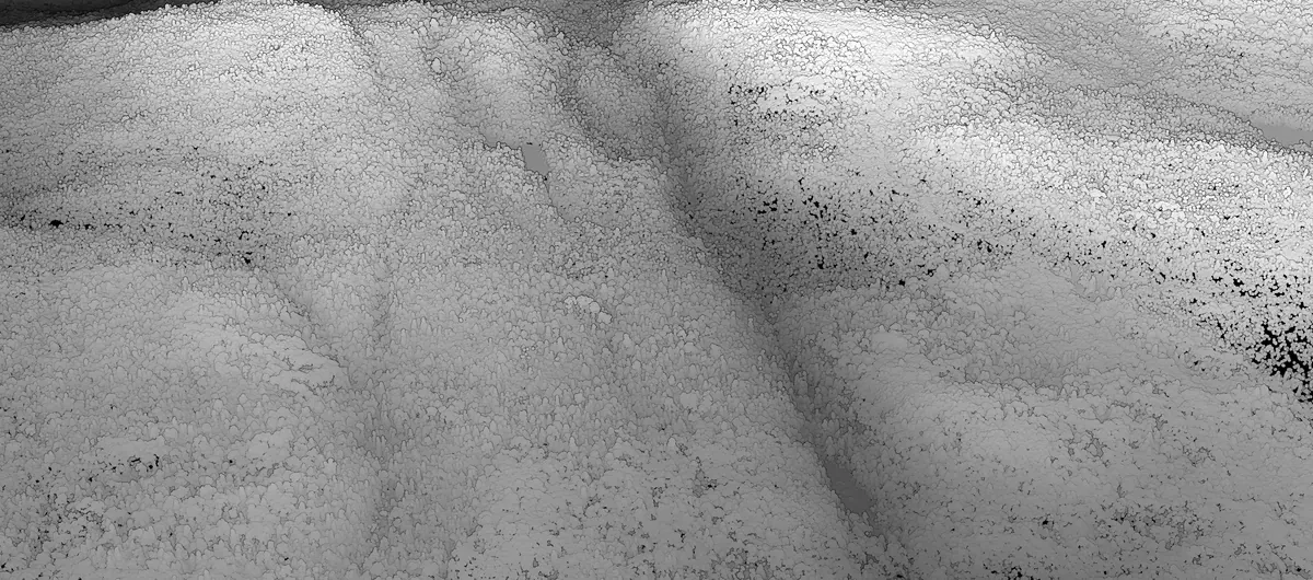
Black and white drone LiDAR terrain model resolving ridges, drainage and structural grain in fine detail
Drone LiDAR point cloud. Full structural and terrain detail.

One mobilization

Does LiDAR need its own survey?

No. LiDAR flies in the same mobilization as magnetics, EM and radiometrics. One crew on site, one co-registered data package.

Because the datasets are acquired together over the same ground, they arrive co-registered: the bare-earth surface, the magnetic grids and the radiometric channels all line up. Your team interprets structure, lithology and terrain in one view instead of forcing separately flown datasets to agree. The terrain model is working data rather than a separate line item, because it feeds the corrections that make the geophysics sharper.

See the full payload →

Proof

Programs clients drilled on

Published programs with the numbers and the client's own words. Larder Lake was flown with magnetics and LiDAR together.

Drone magnetics
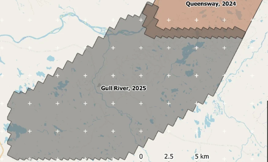
New Found Gold — Gull River survey figure

Gull River

Grand Falls-Windsor, Newfoundland

New Found Gold
315
line-km/day on this program
~4,000
line-km completed

Almost 4,000 line-kilometres acquired across the program, completed on schedule despite delays from a wildfire evacuation interrupting it and geomagnetic storms. Sustained production without trading away data quality.

“The drone magnetic survey provided high-resolution structural insights that significantly improved our understanding of the subsurface geology, allowing us to refine our exploration targets.”

David Drover · Project Geologist

Read the Case Study →
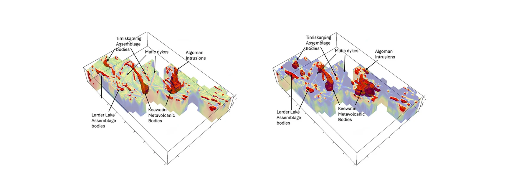

Drone magnetics + LiDAR
Gatling Exploration — Larder Lake survey figure

Larder Lake

Larder Lake, Ontario, Canada

Gatling Exploration
13
priority areas delineated
84
km² surveyed

Thirteen priority areas delineated from ML-assisted interpretation, ranked for follow-up.

“Rosor has helped our exploration efforts both on the ground and with the drill bit utilizing their drone-borne surveys. They communicated effectively throughout the work program and processed the data within our tight time frame. We enjoy working with the team and look forward to using them again.”

Nathan Tribble · VP Exploration

Read the Case Study →

FAQ

Straight answers

01

Do you do LiDAR for construction, forestry, or corridor mapping?

No. Rosor flies LiDAR for mineral exploration, as part of a geophysical survey program. If you need volumetric survey, forestry inventory, or corridor mapping, another provider is the right call and we'll say so rather than take the work.

02

How accurate is the bare-earth model under canopy?

Accurate enough to plan drill pads and trace structure on. Accuracy depends on canopy density, because the model is built from the pulses that reach the ground through gaps. On typical exploration ground in boreal and temperate forest, ground returns are dense enough to resolve topographic breaks that satellite imagery and public elevation data miss entirely.

03

Can LiDAR find mineralization?

Not directly. LiDAR maps the ground surface, not what's in it. What it does is show you where bedrock is exposed so you can sample it, reveal the structural lineaments that control mineralization and give the magnetic and radiometric data a precise surface to be corrected against.

04

Can LiDAR be added to a magnetic survey already planned?

Yes, and that is how most explorers buy it. It flies on the same mobilization, so the add is marginal rather than a second campaign, and the terrain model improves the magnetic and radiometric products you were already paying for.

Talk to an expert

What's under your canopy?

Send the ground. We'll come back with a coverage plan and tell you what LiDAR will add to the program.

Send us your shapefile. We'll come back with a preliminary read, a coverage plan and a budget range.