Rosor Exploration

Case study · Drone magnetics + LiDAR

Thirteen ranked targets from ML-assisted interpretation.

Larder Lake · Larder Lake, Ontario, Canada · 84 km²

13
priority areas delineated
84
km² surveyed
2024→
surveyed 2024 · ground now 100% Pan American Silver

Background

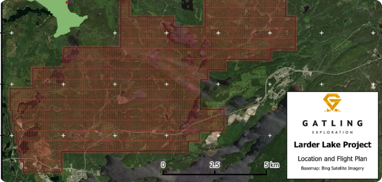
Location and flight plan for the Larder Lake Project over satellite imagery, with the survey blocks outlined
Location and flight plan of the Gatling Larder survey.

Located about 35 km east of Kirkland Lake, Ontario is the Larder Lake Project, a large-scale prospective area owned by Gatling Exploration (“Gatling”). The Larder Lake Project contains five prospective areas for further development that lie along the Larder Lake-Cadillac Deformation Zone, which is host to many high-grade gold deposits including the Kirkland Lake deposit and Kerr-Addison-Chesterville deposit. All five areas have been previously explored, with the Cheminis deposit having been actively explored since 1937. Since Gatling has owned the area in 2018, there has been additional exploration work including collected a fixed-wing Lidar survey to create a 3 m-resolution digital elevation model, a sampling project, and extensive drilling with 134 drillholes for a total of 57,556 m.

Gatling approached Rosor Exploration to produce a high-quality, high-resolution magnetic dataset to expand Gatling's current knowledge of the Larder Lake-Cadillac Break, the dominant belt of volcanics and metamorphosed sediments that marks the boundary between the Abitibi Superior Province to the north and the Timiskaming Assemblage to the south. Due to the swampland nature of Northern Ontario, outcrop is few and far between, meaning it is crucial to get subsurface data by cost-effective means.

Outcome

The Larder Lake Project covers 84 km² over a series of mining claims. Rosor embarked on an ambitious exploration project covering the entire project, which included 2,000 line-km of drone-borne magnetic data, 1,285 line-km of high-resolution Lidar data, and a geophysical interpretation of the area. The drone project started on May 21, 2024, with the 2,000 line-km of magnetic data acquired over 14 days, and the Lidar data acquired over 10 days. Raw data was processed using Oasis Montaj, as well as a newly developed in-house levelling technique specific for drone-borne magnetic data which vastly improved the final magnetic grids. This levelling technique is still used and improved upon for all surveys Rosor flies.

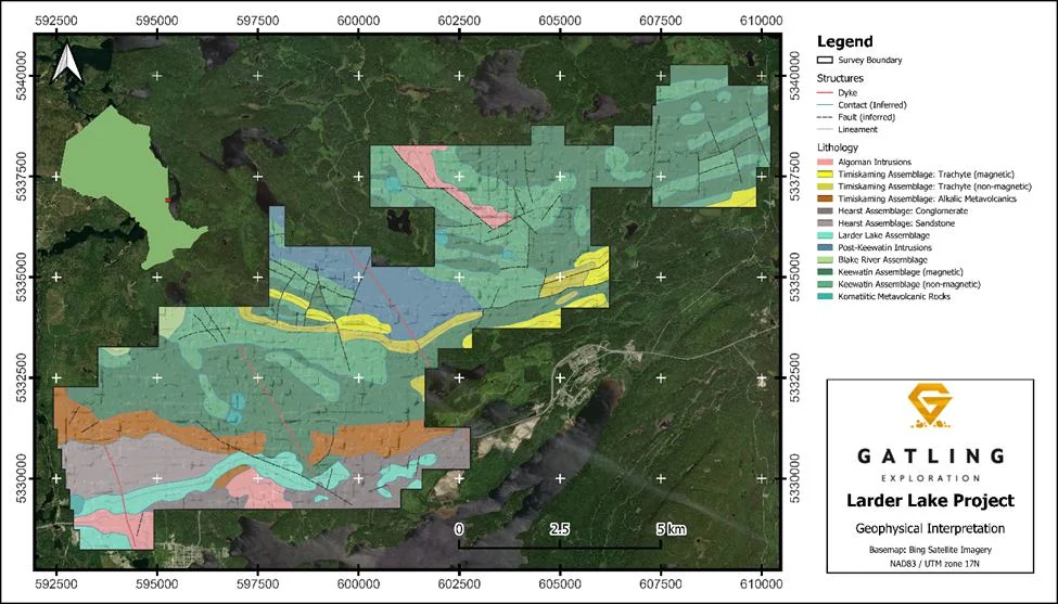
Geophysical interpretation of the project included full lithological and structural interpretations of the area. This comprehensive study was done using a combination of machine-learning techniques to find linear structures, and qualitative interpretation from magnetics, Lidar, geological maps, and drillhole data. The interpretation was done using in-house techniques to carry out the interpretation efficiently and effectively.

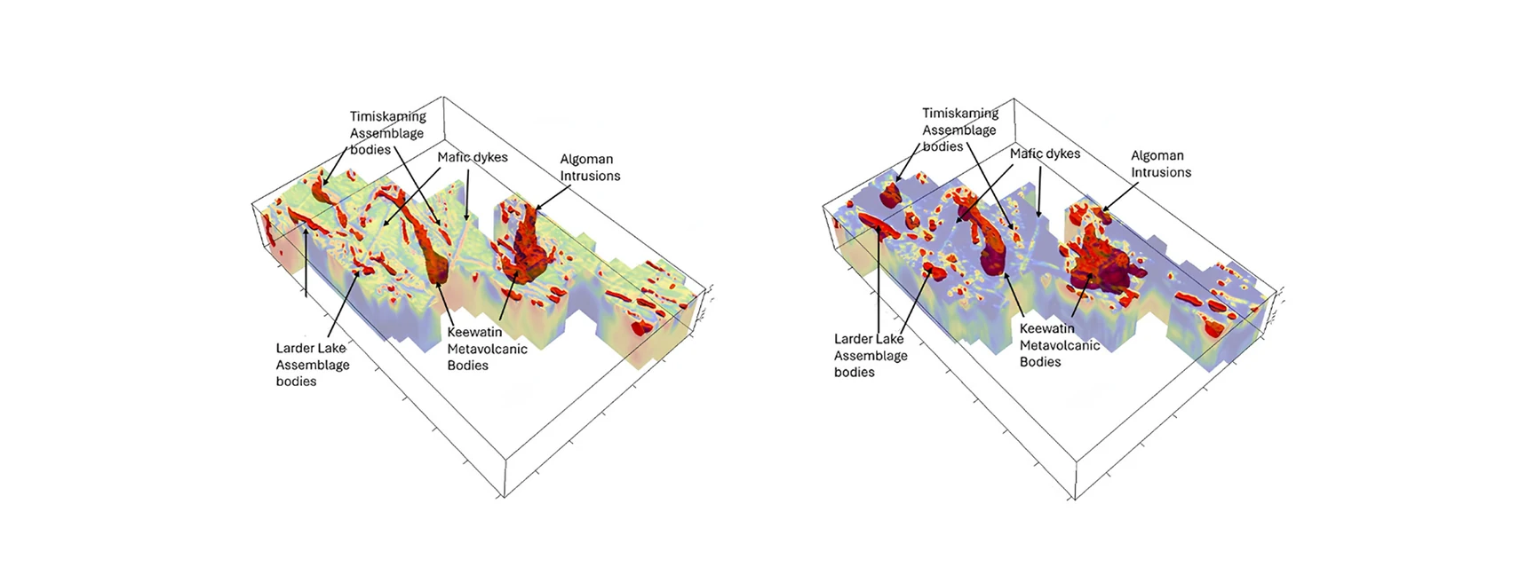
The survey significantly improved the magnetic resolution over the OGS Abitibi Supergrid, highlighting structures and anomalies previously not visible. The geophysical interpretation was successful in highlighting major structures and potential mineralized bodies that enhanced Gatling Exploration's understanding of the geology of the property, with the inversion models successfully mapping out magnetic bodies.

The delivered products, including the selected priority areas, provided to Gatling enhanced their drilling targets, improved site selection for the 2024 field season, and assisted in planning for future exploration projects.

  • Priority areas were delineated from susceptibility and magnetic vector inversions (MVI).
Susceptibility and magnetic vector inversion models for the Larder Lake area, the assemblages and intrusions annotated
Magnetic vector inversion over Larder Lake, with the assemblages and intrusions annotated.
Rosor has helped our exploration efforts both on the ground and with the drill bit utilizing their drone-borne surveys. They communicated effectively throughout the work program and processed the data within our tight time frame. We enjoy working with the team and look forward to using them again.
Nathan Tribble · VP Exploration, Gatling Exploration
Geophysical interpretation map of the Larder Lake Project showing lithology units, dykes, contacts, faults and lineaments over satellite imagery, with legend
The geophysical interpretation of the Larder Lake Project: lithology, structures and lineaments.

The document

The Larder Lake Case Study

The survey volumes, the inversion models and all thirteen ranked priority areas, as delivered to Gatling.

More proof

Other programs

Drone magnetics
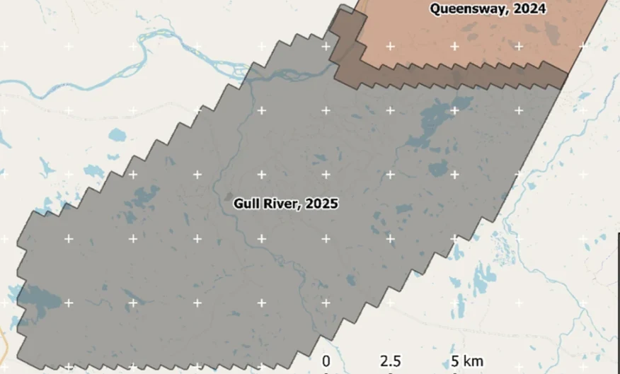
New Found Gold — Gull River survey figure

Gull River

Grand Falls-Windsor, Newfoundland

New Found Gold
315
line-km/day on this program
~4,000
line-km completed

Almost 4,000 line-kilometres acquired across the program, completed on schedule despite delays from a wildfire evacuation interrupting it and geomagnetic storms. Sustained production without trading away data quality.

“The drone magnetic survey provided high-resolution structural insights that significantly improved our understanding of the subsurface geology, allowing us to refine our exploration targets.”

David Drover · Project Geologist

Read the Case Study →
Drone magnetics
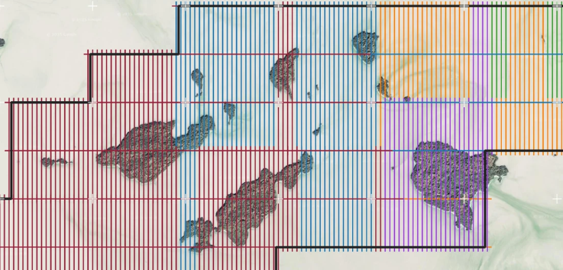
International Explorers & Prospectors — Abitibi Lake survey figure

Abitibi Lake

Abitibi Lake, Ontario, Canada

International Explorers & Prospectors
10
days, site to deliverables
3
days of acquisition

Mobilization to final deliverables in ten days, with acquisition complete in three and no mechanical downtime.

“Throughout the duration of the project, Rosor maintained clear and efficient communication with our team. They demonstrated a strong commitment to meeting deadlines by processing the collected data within a very tight time-frame, ensuring that our exploration schedule remained on track.”

Peter Colbert · CFO

Read the Case Study →

Talk to an expert

Is your ground like this one?

Send the shapefile and the target model. We'll tell you what the survey would show.

Send us your shapefile. We'll come back with a preliminary read, a coverage plan and a budget range.