Rosor Exploration

Case study · Drone magnetics

Site to final deliverables in ten days.

Abitibi Lake · Abitibi Lake, Ontario, Canada · 360 line-km

10
days, site to deliverables
3
days of acquisition
0
mechanical issues

Background

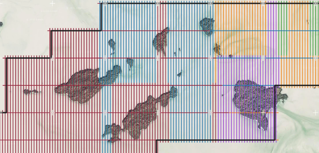
Flight plan for the Abitibi Lake survey, the daily acquisition blocks coloured by day
The Abitibi Lake flight plan, acquired in three days and delivered in ten.

Located about 50 km northeast of Matheson, Ontario is the Abitibi Lake Project, a small-scale prospective area owned by International Explorers & Prospectors Inc. (IEP). The area has intense deformation, with E-W oriented faults on the southern end of the property which shows displacement of the ultramafic metavolcanic bands. The Abitibi Lake Project resides over a portion of Abitibi Lake, which means that geophysical and drilling are heavily relied upon to further the understanding of the underlying geology in the area.

The Abitibi Lake Project covers 16.7 km² over a series of mining claims. Rosor typically deploys LiDAR with magnetic data due to sufficient drone compatibility; however, due to the lack of topographic relief, only magnetics was deployed. Rosor planned a high-resolution survey consisting of 360 line-km at 50 m spacing.

Outcome

Calibration flights occurred the day after arrival to site and mobilization, with acquisition starting in the northeast corner later that day. Acquisition of all lines was completed within the following three days with minimal delays and no mechanical issues.

This was the last project where magnetic data was processed by Paterson, Grant & Watson (PGW) before bringing magnetic processing in-house. The acquired data was transferred to PGW the day after acquisition and demobilization was completed, showing how Rosor's in-house techniques allow quick turnover for processing. Due to the quality of the raw dataset as well as a refined workflow stemming from Rosor and PGW's two-year relationship, processing from raw data to final deliverables was completed within two days. In total, it took ten days from the day Rosor arrived at site to deliver final products to IEP.

The Abitibi Lake survey now serves as the benchmark survey where all parties were in complete harmony. Since Abitibi Lake, turnover of processed magnetic data has averaged less than a week once acquisition was completed. Rosor strives to deliver for every client: a survey where mechanical issues are non-existent, data acquisition is smooth, and a quick turnover of high-quality products that help lead to the next major discovery.

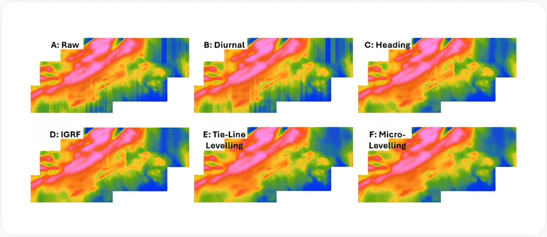
Six panels showing the processing flow for the Abitibi Lake magnetics: raw, diurnal, heading, IGRF, tie-line levelling and micro-levelling corrections
The processing flow, from raw magnetic intensity to microlevelled residual magnetic intensity.
Throughout the duration of the project, Rosor maintained clear and efficient communication with our team. They demonstrated a strong commitment to meeting deadlines by processing the collected data within a very tight time-frame, ensuring that our exploration schedule remained on track.
Peter Colbert · CFO, International Explorers & Prospectors
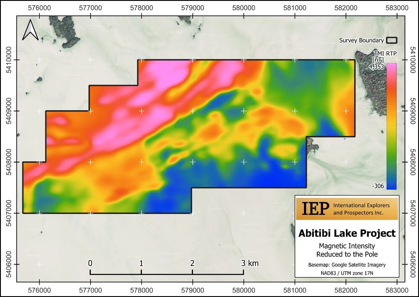
Total magnetic intensity reduced to the pole over the Abitibi Lake Project, with survey boundary, colour scale and IEP project card
One of the product deliverables: magnetic intensity reduced to the pole over the Abitibi Lake Project.

The document

The Abitibi Lake Case Study

The ten-day program in full, including the processing flow that took raw data to final deliverables in two days.

More proof

Other programs

Drone magnetics
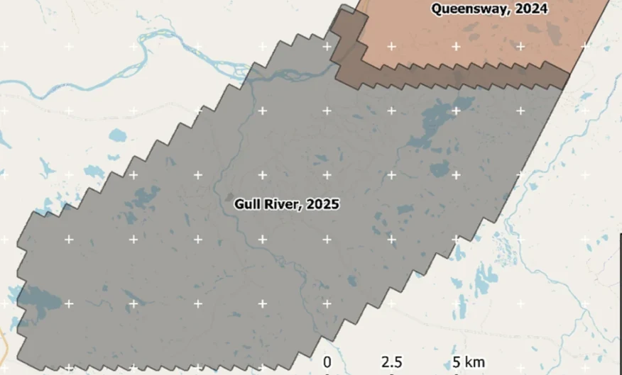
New Found Gold — Gull River survey figure

Gull River

Grand Falls-Windsor, Newfoundland

New Found Gold
315
line-km/day on this program
~4,000
line-km completed

Almost 4,000 line-kilometres acquired across the program, completed on schedule despite delays from a wildfire evacuation interrupting it and geomagnetic storms. Sustained production without trading away data quality.

“The drone magnetic survey provided high-resolution structural insights that significantly improved our understanding of the subsurface geology, allowing us to refine our exploration targets.”

David Drover · Project Geologist

Read the Case Study →

Drone magnetics + LiDAR
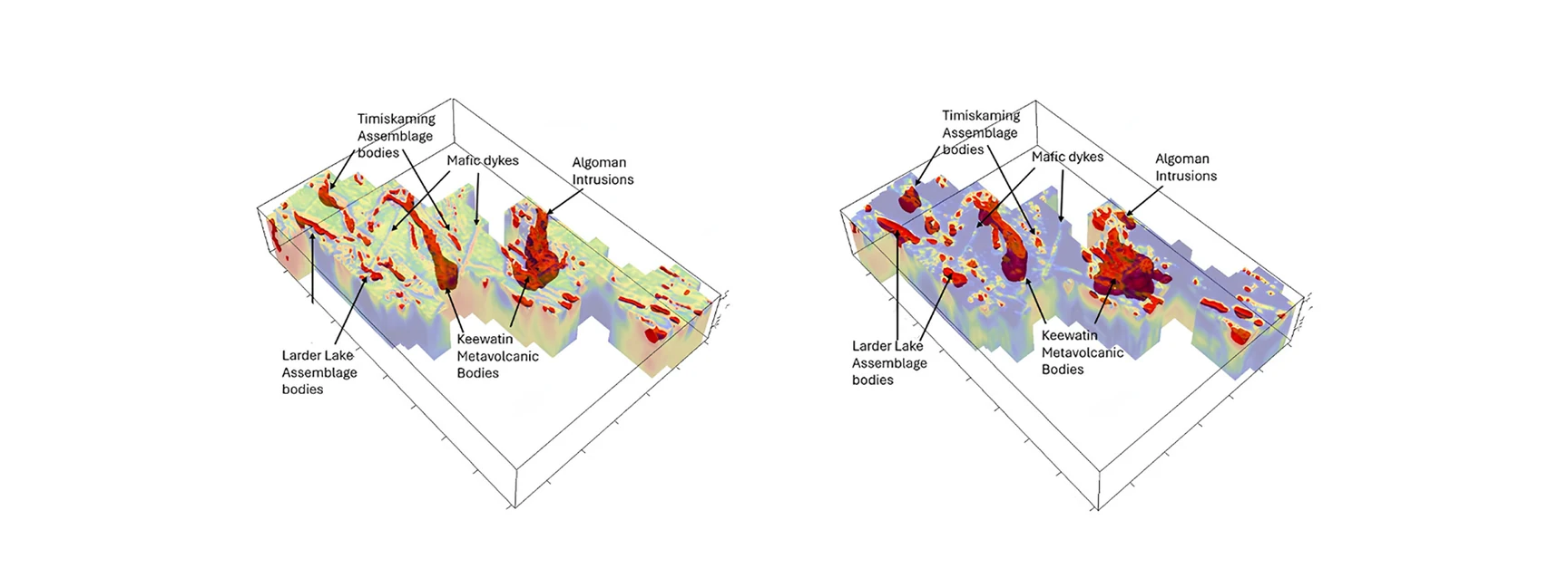
Gatling Exploration — Larder Lake survey figure

Larder Lake

Larder Lake, Ontario, Canada

Gatling Exploration
13
priority areas delineated
84
km² surveyed

Thirteen priority areas delineated from ML-assisted interpretation, ranked for follow-up.

“Rosor has helped our exploration efforts both on the ground and with the drill bit utilizing their drone-borne surveys. They communicated effectively throughout the work program and processed the data within our tight time frame. We enjoy working with the team and look forward to using them again.”

Nathan Tribble · VP Exploration

Read the Case Study →

Talk to an expert

Is your ground like this one?

Send the shapefile and the target model. We'll tell you what the survey would show.

Send us your shapefile. We'll come back with a preliminary read, a coverage plan and a budget range.