Rosor Exploration
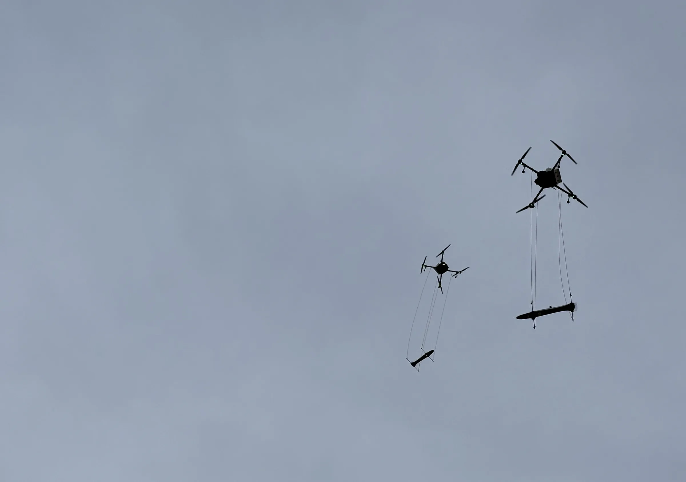
Two Rosor survey drones in flight, each carrying a sensor slung beneath it

Electromagnetic surveys

The results most drone surveys can't give you.

Semi-airborne electromagnetics (SAEM) maps conductors at depth, in the same mobilization as your magnetics.

Magnetics responds to magnetization and SAEM to conductivity, so your team can rank drill targets on two physical properties.

The method

What is a SAEM survey?

SAEM is frequency-domain semi-airborne electromagnetics. The dipole is installed on the ground while the receiver flies on the drone. Frequency-domain EM transmits electromagnetic signals at multiple discrete frequencies and measures the ground's response to each, providing information on subsurface conductivity and how it varies with depth. SAEM can detect conductors from surface up to 1000 m.

Lower frequencies penetrate deeper and higher frequencies resolve the near surface. Actual depth depends on ground conductivity and target size.

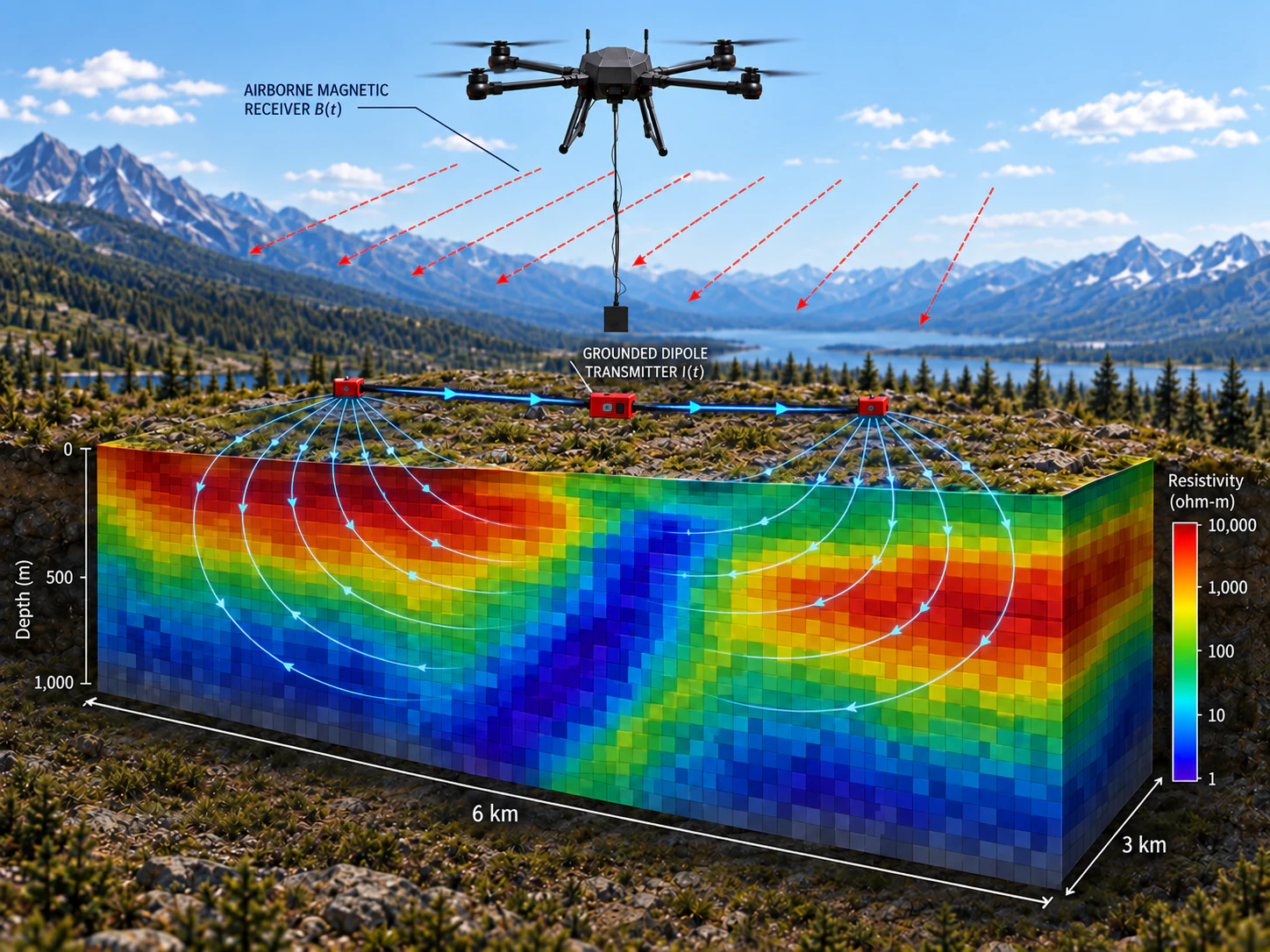
A drone flies over the survey area with a magnetic receiver hanging below it. On the ground, a transmitter on a wire drives current between two electrodes, and the current flows through the subsurface. A cut-away block below shows the resulting resistivity model, from 1 to 10,000 ohm-metres, down to 1,000 m depth across an area 6 km by 3 km.
  1. Current goes into the ground

    A grounded transmitter drives a strong, controlled current through a long wire grounded at both ends.

  2. Conductors respond

    The electromagnetic field spreads through the subsurface, and conductive bodies, such as massive sulphides, develop induced currents.

  3. The drone measures the response

    A Rosor drone flies the survey lines with a three-axis magnetic receiver suspended below it, recording the response in the air.

  4. Split into frequencies

    The response is converted to frequency-domain data. Lower frequencies read deeper, and higher frequencies resolve the near surface.

  5. A resistivity model

    The data are inverted into a 2D or 3D resistivity model, from surface down to 1000 m depending on target size, conductivity and host-rock resistivity.

What it detects

What does EM detect?

EM detects contrasts in the electrical conductivity of the ground. Where sulphides such as pyrrhotite, pentlandite and chalcopyrite are massive and electrically connected, they form conductors, which are common EM targets in nickel-copper and base-metal systems.

  1. 01

    Detecting conductors

    Massive sulphide bodies can resolve as discrete conductors, depending on size, depth and ground conductivity. SAEM data give your team each conductor's approximate position, depth and extent before drills are committed, so the first hole is aimed rather than drilled blind.

  2. 02

    Ranking conductors

    Graphite and saline groundwater conduct too. Reading the conductors against the magnetics, and against your geological mapping, helps your geologists rank them, so the most prospective targets are drilled ahead of the look-alikes that waste metres.

  3. 03

    Combining magnetics and EM

    Magnetics maps contrasts in magnetization, from which structure and lithological contacts are read. EM maps contrasts in conductivity. Together they give you two different physical properties to follow a target along strike and at depth.

When it fits

When is semi-airborne EM the right tool?

Semi-airborne EM is well suited to focused exploration programs where the objective is to map conductivity at depth while maintaining dense, efficient sensor readings.

  1. 01

    When the target is deep

    A grounded transmitter introduces a strong controlled EM source directly into the earth while the drone maps the resulting field across the survey area. This configuration can provide sensitivity to conductors from near surface to significant depths. Actual depth of investigation depends on target size, conductivity, geometry, host-rock resistivity and survey configuration, so expected target depth is one of the first parameters considered during survey design.

  2. 02

    When conductive cover is part of the problem

    Conductive overburden attenuates EM response and can reduce effective depth of investigation for any EM system. SAEM uses a grounded electrical source rather than relying solely on an airborne inductive transmitter, providing stronger coupling with the subsurface and potentially improving sensitivity to geological conductors beneath conductive cover. The thickness and conductivity of that cover still ultimately control how much of the deeper response can be resolved.

  3. 03

    When you need detailed coverage

    Transmitter locations and geometry are planned around the geological target. The ground transmitter is installed based on the survey configuration. The receiver is flown systematically across the survey area. This allows dense spatial sampling without positioning a receiver station along every survey line, combining the stronger source characteristics of ground-based EM with the coverage efficiency of an airborne platform.

  4. 04

    When conductivity and resistivity are the exploration questions

    SAEM measures the electromagnetic response of the subsurface and is used to model variations in electrical resistivity. It is particularly applicable where conductive geology (massive or semi-massive sulphides, graphite, conductive structures or alteration) provides a contrast with the surrounding rocks. It does not measure chargeability, so where induced-polarization response is the primary exploration objective, IP remains a different and complementary method.

Delivery record

How our programs run in the field

Two published drone magnetics programs, with the figures and the clients' own words.

Drone magnetics
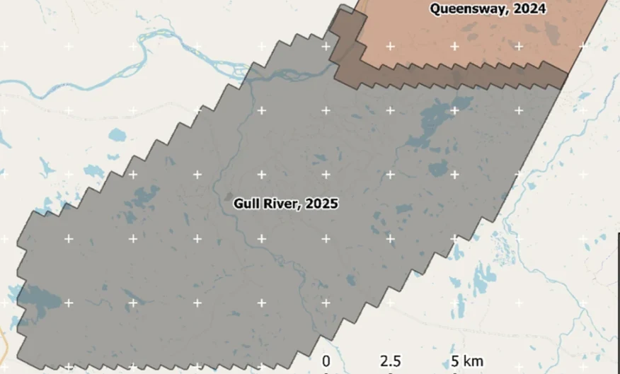
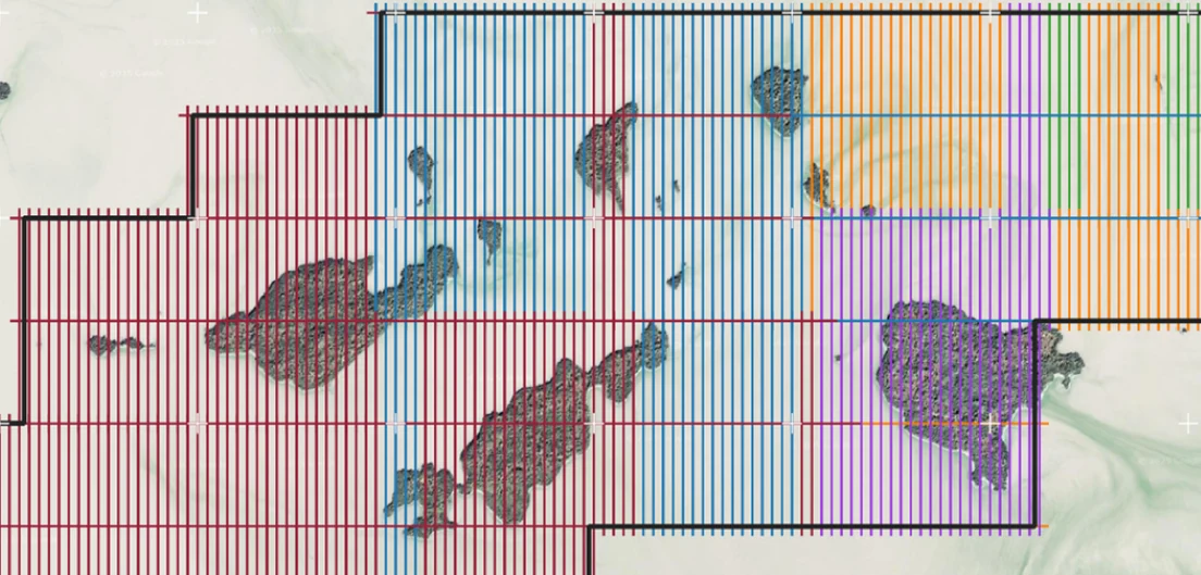
New Found Gold — Gull River survey figure

Gull River

Grand Falls-Windsor, Newfoundland

New Found Gold
315
line-km/day on this program
~4,000
line-km completed

Almost 4,000 line-kilometres acquired across the program, completed on schedule despite delays from a wildfire evacuation interrupting it and geomagnetic storms. Sustained production without trading away data quality.

“The drone magnetic survey provided high-resolution structural insights that significantly improved our understanding of the subsurface geology, allowing us to refine our exploration targets.”

David Drover · Project Geologist

Read the Case Study →

Drone magnetics
International Explorers & Prospectors — Abitibi Lake survey figure

Abitibi Lake

Abitibi Lake, Ontario, Canada

International Explorers & Prospectors
10
days, site to deliverables
3
days of acquisition

Mobilization to final deliverables in ten days, with acquisition complete in three and no mechanical downtime.

“Throughout the duration of the project, Rosor maintained clear and efficient communication with our team. They demonstrated a strong commitment to meeting deadlines by processing the collected data within a very tight time-frame, ensuring that our exploration schedule remained on track.”

Peter Colbert · CFO

Read the Case Study →

FAQ

Straight answers

01

How deep does the EM see?

From surface down to 1000 m. The transmitter is installed on the ground while the receiver flies on the drone. Actual depth depends on ground conductivity and target size, and resolution decreases with depth. If your target sits deeper than SAEM reads in your ground, we'll say so and tell you which method fits it.

02

How does SAEM compare to heliborne EM?

SAEM suits focused prospects. A transmitter installed on the ground and a receiver flown on our own drones map conductors and resistivity contrasts across the target area, from surface down to 1000 m, in the same mobilization as your magnetics. Regional and basin-scale coverage remains conventional airborne work. Target depth, ground conductivity and survey area decide which fits, and we'll tell you in the first conversation.

03

How does SAEM compare to ground EM?

SAEM, like fixed-source ground EM, uses a transmitter installed on the ground. The difference is the receiver: it flies on the drone, so it covers the survey area much more quickly, with no cut lines for a receiver grid. Ground EM can still be the right call for detailed follow-up on a single known conductor. SAEM is for mapping conductors and resistivity contrasts across a target area before that commitment.

04

What does a SAEM survey deliver?

Resistivity models. SAEM data are inverted into 2D or 3D resistivity models of the survey area. The models, formats and interpretation scope for your program are set out in the proposal.

05

Can SAEM be combined with magnetics and radiometrics in one program?

Yes. One mobilization can cover magnetics, SAEM, radiometrics and LiDAR over the same ground, so your team reads structure, resistivity, surface radiometrics and terrain together.

Talk to an expert

Bring your conductor question to a geophysicist.

Share what you know of the target and the ground, and we'll tell you plainly whether SAEM suits it.

Send us your shapefile. We'll come back with a preliminary read, a coverage plan and a budget range.