Rosor Exploration
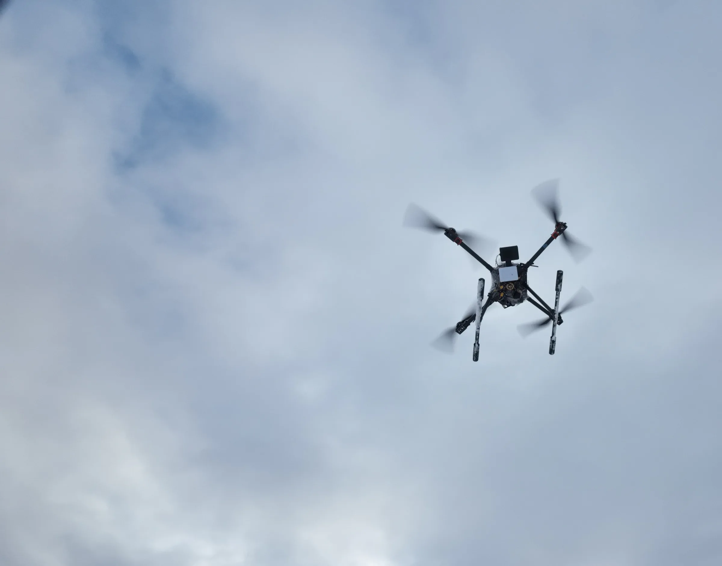
A Rosor survey drone in flight against overcast winter cloud

Drone magnetic surveys

Drone magnetic surveys that reveal structure and magnetic anomalies.

Magnetics is the first read of almost every drilling project. It maps structural corridors and lithological contacts under cover, along strike and at depth.

Rosor flies high-resolution magnetics low and tight to the terrain, reviews every line on site before demobilizing, and delivers grids and inversions your team can use.

What it resolves

What does a drone magnetic survey resolve?

Structure and lithology are what guide drill planning: faults, contacts and intrusions. Magnetic data reads through overburden, so corridors invisible at surface show up in the grid, and where alteration has produced a magnetic contrast it shows up with them.

  1. 01

    Structure

    Faults, shears and fold hinges show as breaks and offsets in the magnetic fabric. For structurally controlled deposits, these corridors are where the targets live.

  2. 02

    Lithology

    Rock units carry different magnetic signatures. Contacts between them map cleanly even under tens of metres of cover, and those contacts are often the host setting for mineralization.

  3. 03

    Mineral deposits

    By detecting characteristic magnetic signatures associated with specific deposit types and alteration systems.

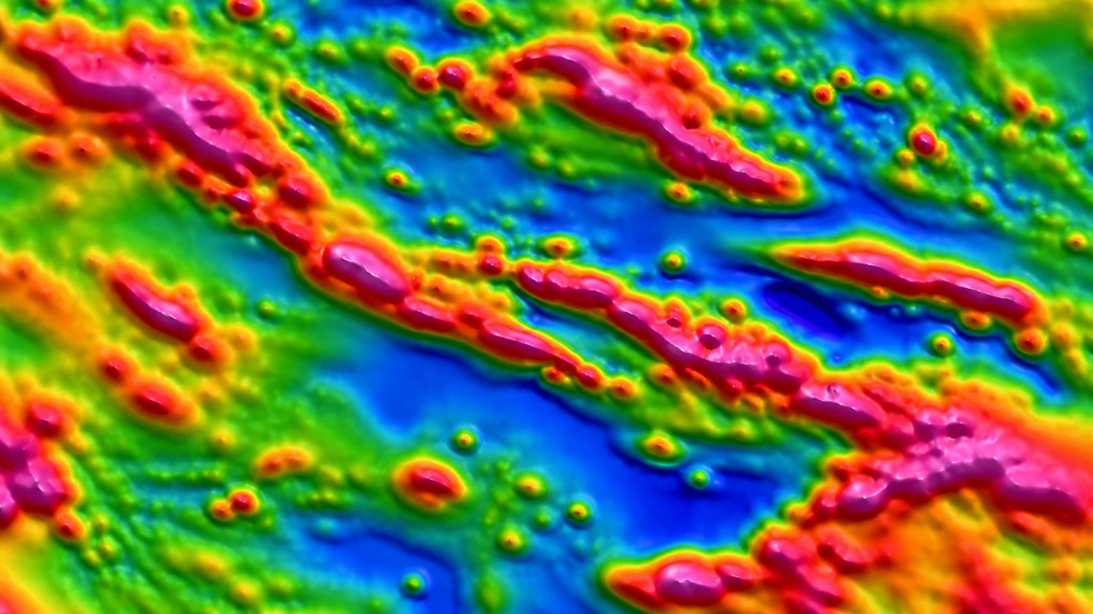
Total magnetic intensity map from a Rosor drone survey: structural corridors running through the magnetic fabric with discrete anomalies along them
Illustration of a total magnetic intensity map.

Flight height

How low do you fly?

We fly 5–100 m above ground and follow the terrain. The drone holds its clearance over every ridge and gully, not just the average.

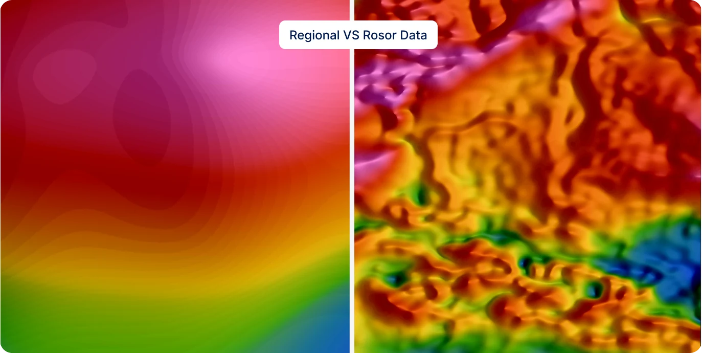
The magnetic signal reduces with distance from the source. Lowering the flight height sharpens anomalies and separates sources that would smear together from higher up. Combined with the right line spacing, the final grid resolves the structures you want to see.

A regional magnetic grid beside a Rosor drone magnetic survey of the same ground
The same area with magnetic data: regional line spacing vs. Rosor's.

Data quality

Is the data checked before the crew leaves?

The Rosor Zephyr Mag reports data-quality metrics which are reviewed daily. This allows the field team to adjust acquisition while the survey is underway and ensure a high-quality final dataset.

Every flight plan includes the cross-check geometry that lets processing verify and level the dataset. Those are the quality checks some bids quietly skip.

How we keep data clean →
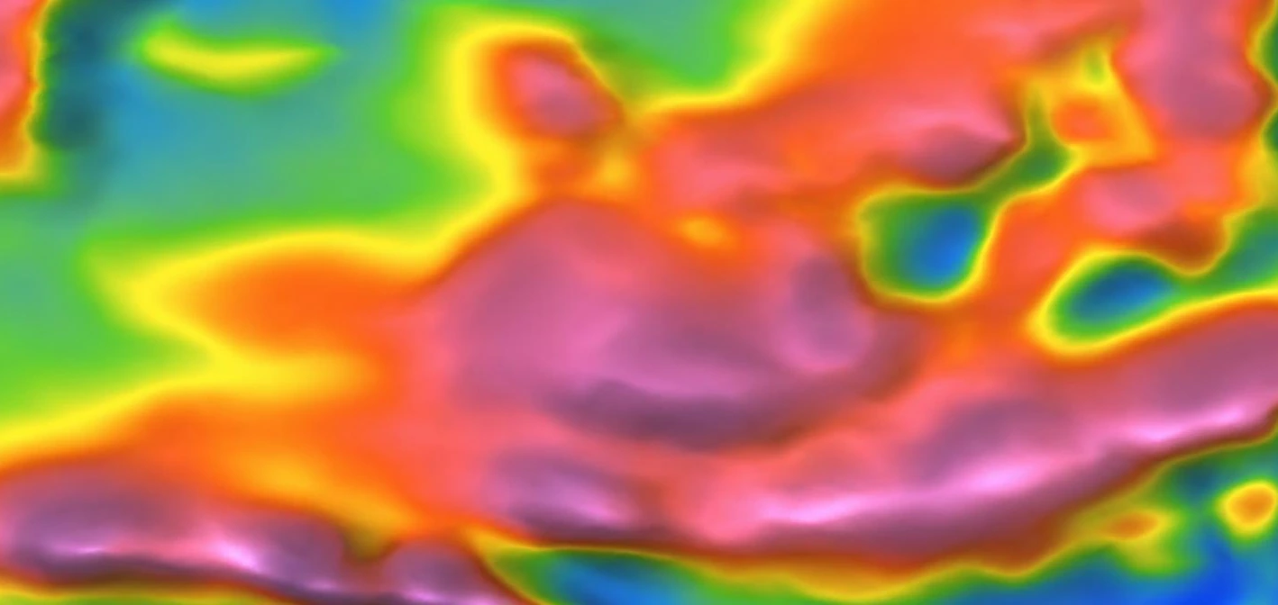
Residual magnetic intensity, reduced to the pole, from a Rosor drone magnetic survey: colour relief showing anomaly and structural detail
Residual magnetic intensity, reduced to the pole. A Rosor drone-mag deliverable.

Proof

Programs clients drilled on

Published magnetic programs with the numbers and the client's own words.

Drone magnetics
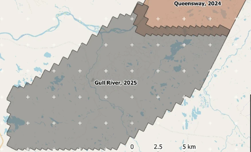
New Found Gold — Gull River survey figure

Gull River

Grand Falls-Windsor, Newfoundland

New Found Gold
315
line-km/day on this program
~4,000
line-km completed

Almost 4,000 line-kilometres acquired across the program, completed on schedule despite delays from a wildfire evacuation interrupting it and geomagnetic storms. Sustained production without trading away data quality.

“The drone magnetic survey provided high-resolution structural insights that significantly improved our understanding of the subsurface geology, allowing us to refine our exploration targets.”

David Drover · Project Geologist

Read the Case Study →

Drone magnetics
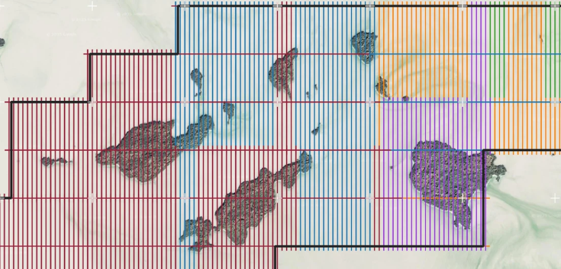
International Explorers & Prospectors — Abitibi Lake survey figure

Abitibi Lake

Abitibi Lake, Ontario, Canada

International Explorers & Prospectors
10
days, site to deliverables
3
days of acquisition

Mobilization to final deliverables in ten days, with acquisition complete in three and no mechanical downtime.

“Throughout the duration of the project, Rosor maintained clear and efficient communication with our team. They demonstrated a strong commitment to meeting deadlines by processing the collected data within a very tight time-frame, ensuring that our exploration schedule remained on track.”

Peter Colbert · CFO

Read the Case Study →

FAQ

Straight answers

01

What does a magnetic survey detect for gold exploration?

Structures and indicator minerals, not the gold itself. Gold is non-magnetic, so magnetics maps the plumbing: the faults and shears that channelled fluids, plus magnetite and pyrrhotite that often accompany mineralization. Geophysics is not a gold detector. It tells you where the system is so drilling can test it.

02

How do you choose line spacing?

From the target, together with your geologists. Whatever you already know about the deposit style, the likely target size and strike direction shapes the spacing and orientation, and a narrow-vein system needs tighter lines than a broad porphyry halo. Flying at 5–100 m AGL supports tighter spacing than a higher platform can resolve.

03

What deliverables do we get?

Files that open in Leapfrog, QGIS and ArcGIS: DXF and isosurfaces, geotiffs that go into your existing datasets, levelled grids and an unconstrained VOXI model, interpretation-ready as standard. An interpretive report with drill-target recommendations comes with scoped interpretation.

04

How fast can a survey happen?

Send a shapefile and we'll come back with a preliminary read, a coverage plan and a budget range inside a week, and we mobilize on a contract. In the field, crews fly up to 500 line-km a day with multi-drone surveys on open ground within reach of roads, and less where terrain or access is harder. Deliverables arrive within an average of 15 business days of completion.

05

How does drone resolution compare to a helicopter survey?

The drone flies the sensor at 5–100 m above ground with terrain-following. Closer to source means sharper anomalies and support for tighter line spacing. On a focused program that resolution difference is visible in the grid.

Talk to an expert

Send us the ground you're working.

A shapefile and a target model are enough. We'll come back with a coverage plan and a budget range.

Send us your shapefile. We'll come back with a preliminary read, a coverage plan and a budget range.