Three blocks, including a flawed legacy survey, merged into one grid.
Cochrane Hill · Melrose, Nova Scotia, Canada · ~55 km²
~55
km²
3→1
blocks merged
Weeks
mobilized on a few weeks' notice
Background
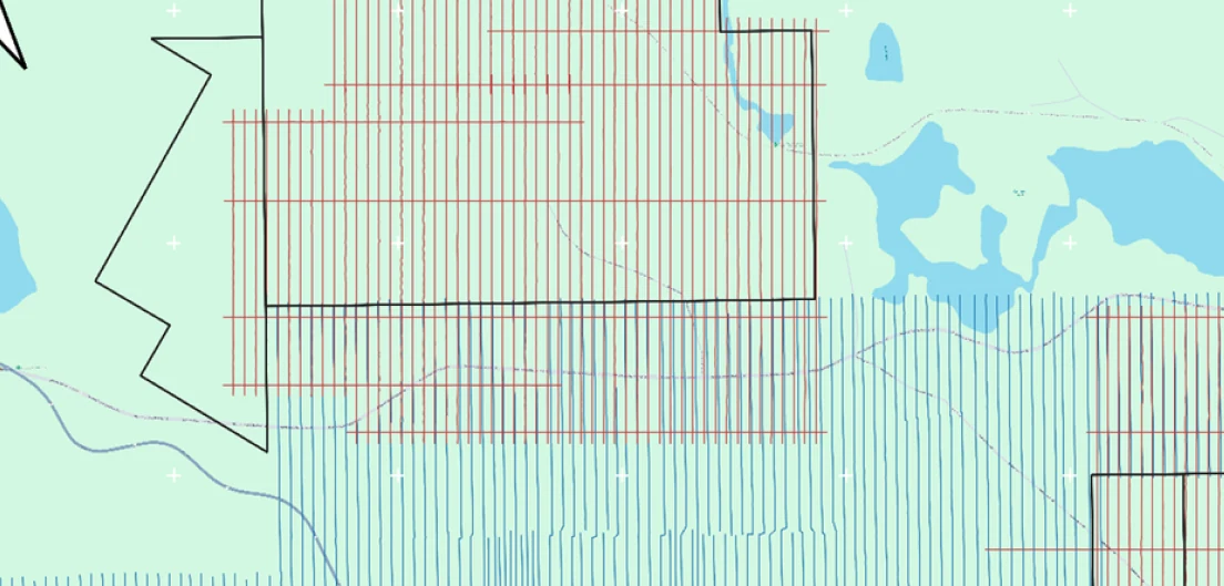
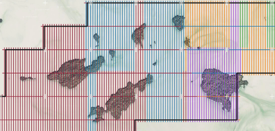
The flight plan: Rosor's two blocks overlapping the earlier survey, with cross-check lines extended across the joins.
Located 10 km north of Sherbrooke, Nova Scotia is the Cochrane Hill Project, a project fully owned by Atlantic Mining NS Inc., a subsidiary of St. Barbara. Cochrane Hill is a legacy gold deposit within the Goldenville Group as part of a tight-to-isoclinal fold. Rosor was contracted to fly 1,000 line-km of drone-borne magnetics in two separate blocks. The blocks were designed around a previous drone-borne magnetic survey flown in 2019 by another contractor. Rosor was tasked collecting and processing data, to merge the data with the previous drone survey, and to delineate the magnetic bodies hosting the Cochrane Hill deposit.
The Cochrane Hill survey comprise two survey blocks that total 42.17 km², and served as a northern extension and an eastern extension of the previous drone-borne survey (12.6 km²). The survey was designed using the same line orientation and spacing as the previous survey with an overlap of 100 m to ensure a seamless merge. Special attention was taken to ensure that traverse lines overlapped almost perfectly with the previous survey, and tie lines were extended in the overlap areas to help level the previous survey prior to merging.
Outcome
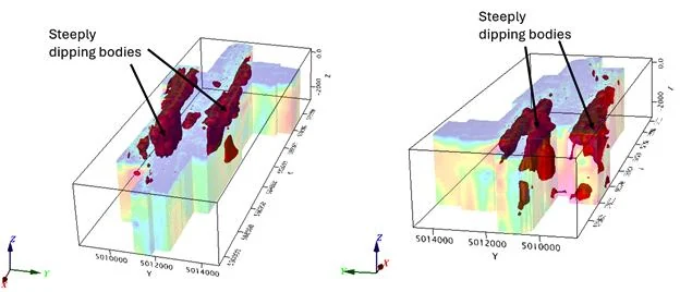
The MVI model for the Cochrane Hill survey, with 0.003 SI isosurfaces delineating the steeply dipping bodies.
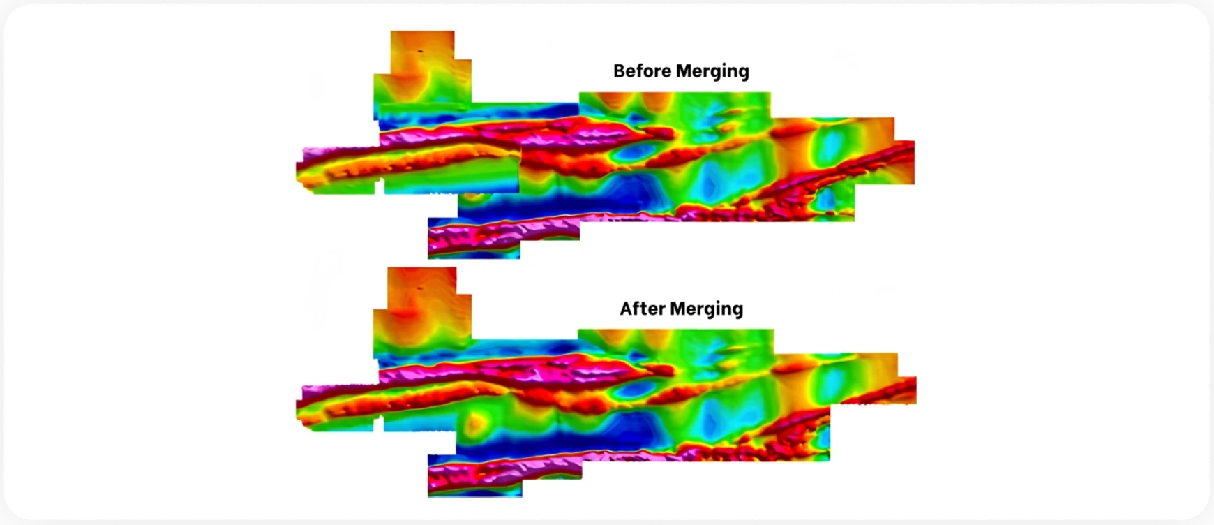
The previous was reviewed to determine if any additional processing was needed. The provided survey deliverables were gridded using a 25 m cell size or ½ the line spacing, whereas Rosor's standard cell size for gridding magnetic data is 1/5 line spacing or 10 m in this case. When gridding the previous survey at our standard cell size, line-related noise was highly evident. Thus, it was determined that additional levelling and microlevelling was needed to clean up the data. The results of the additional levelling made for a large improvement and was sufficient for knitting the survey with Rosor's processed data.
The suture stitch method was used to merge the surveys together which defines a line through overlaps between the two grids, and uses the difference in grid values to adjust the grids to each other for a seamless overlap. The result was a high-resolution merged dataset that identified multiple E-W trending magnetic anomalies. Magnetic vector inversion (MVI) was performed on the merged grids to delineate the magnetic bodies associated with gold mineralization. The inversions proved successful, highlighting two strong steeply-dipping magnetic bodies associated with the Cochrane Hill anticline, a tight isoclinal fold within the Goldenville Group.
Rosor successfully collected, processed, reprocessed, and merged three separate magnetic datasets into a single cohesive survey covering the full Cochrane Hill Project. The previous contractor's dataset, which lacked tie-lines and carried significant line-related noise, was reprocessed using custom levelling and microlevelling techniques that substantially improved overall quality before merging.
The program was mobilized and completed within a tight timeframe, demonstrating Rosor's ability to respond quickly and deliver under schedule pressure without compromising data quality or processing standards.
Magnetic vector inversion (MVI) was run on the merged grids.
“
Rosor managed to get a team onsite with only a few weeks' notice so that our survey could be completed within our tight timeframe. They also did a great job of merging a previous magnetic dataset with the newly captured data to create some impressive regional imagery.
Daniel McDwyer · Manager of Exploration, Australia & Atlantic, St. Barbara
The previous survey and Rosor's drone-borne magnetic surveys, before and after merging.
The document
The Cochrane Hill Case Study
How a legacy survey was diagnosed, relevelled and knitted together with two new blocks into one grid.
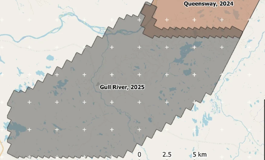
Almost 4,000 line-kilometres acquired across the program, completed on schedule despite delays from a wildfire evacuation interrupting it and geomagnetic storms. Sustained production without trading away data quality.
“The drone magnetic survey provided high-resolution structural insights that significantly improved our understanding of the subsurface geology, allowing us to refine our exploration targets.”
Mobilization to final deliverables in ten days, with acquisition complete in three and no mechanical downtime.
“Throughout the duration of the project, Rosor maintained clear and efficient communication with our team. They demonstrated a strong commitment to meeting deadlines by processing the collected data within a very tight time-frame, ensuring that our exploration schedule remained on track.”